
Department Ain Population (2008) 746 Local time Sunday 5:20 AM | Area 11.6 km² | |
 | ||
Weather 6°C, Wind S at 6 km/h, 80% Humidity Points of interest Musée Escale Haut‑Rhône, Mont de Cordon, Château de la Barre | ||
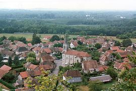
Brégnier-Cordon is a commune in the Ain department in eastern France.
Contents
Map of 01300 Br%C3%A9gnier-Cordon, France
The municipalities near the city are Izieu, Murs-et-Gélignieux, Prémeyzel, Saint-Genix Guiers, Champagneux, St. Benedict, Granieu, Peyrieu, Chimilin, Conzieu, and Romagnieu.
Geography
Brégnier-Cordon lies 20 km south of Belley. It is located in a bend of the Rhône on the edge of Savoy (on the southeast) and Isère (on the west). The bridge at Cordon joins the commune to Aoste, in the Isère department.
The territory of the commune lies principally in the plain of the Rhône at the foot of the Jura mountains. On the north, it is bordered by the Gland.
The Lake of Glandieu is located in the commune near the hamlet of the same name.
Transportation
The commune is on the D19 highway coming from Sault-Brénaz and going to the northwest. This becomes the D992 south of the commune and heads north toward Belley. The D10 passes north of the commune, connecting the D19 to the D992 without following the Rhône.
The closest motorway is the A43, accessed at the Chimilin–Les Abrets exit a few kilometers south of the commune.