
Time zone EET (UTC+2) Licence plate 20 Elevation 867 m | Region Aegean Postal code 20x xx Website www.bozkurt.bel.tr Local time Friday 8:17 PM | |
 | ||
Weather 7°C, Wind W at 0 km/h, 83% Humidity | ||
Bozkurt is a town and a rural district of Denizli Province in the Aegean Region of Turkey. The town is situated on a plain 52 km (32 mi) east of the city of Denizli. The altitude of the town is 866.8 m, and the district area is around 400 km2 (150 sq mi). The population (2000 census) is 11,738 of which 4,589 live in the small town of Bozkurt itself (with the remainder in surrounding countryside). It is quite close to the Lake Acıgöl and the neighboring town of Çardak and İnceler Kasabası
Map of Bozkurt, Denizli, Turkey
This is high country inland from the Aegean and Mediterranean, and has hot, dry summers and cold, wet winters.
During the Russo-Turkish War (1877–1878) refugees from Bulgaria were settled on the plain, which was then known as Hanabat after a Seljuk Turkish caravanserai that stands within the boundaries of the present-day neighboring district of Çardak. Immigration from Bulgaria continued until recent times.
This is an agricultural district, with irrigation systems currently being constructed.
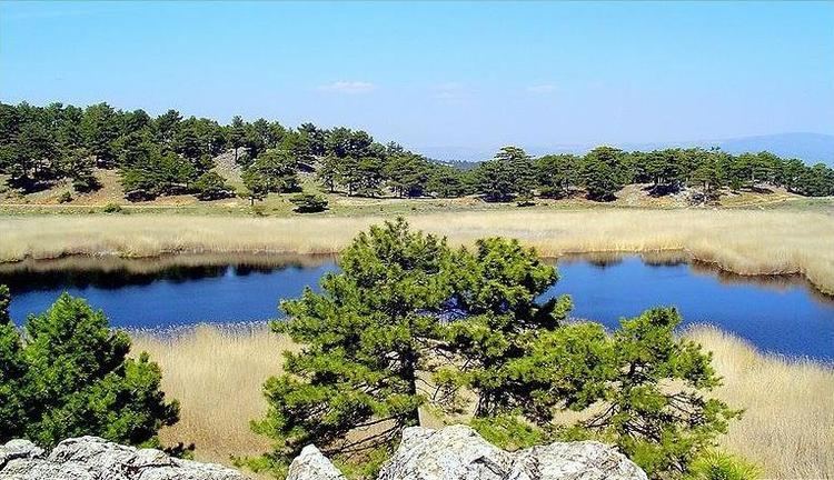
A notable sight of interest is Karagöl, literally "the black lake". Situated on top of the mountain on the slopes of which the town of Bozkurt is located, Karagöl is at an altitude of 1,250 m. and is area of dense forests centered on several small crater lakes which are also fed by streams. The lakes are much visited due to the natural beauty of the scenery and for their fish.