Girish Mahajan (Editor)

Boutonne

Updated on
Edit
Like
Comment
Share on FacebookTweet on TwitterShare on LinkedInShare on Reddit
River mouth
  
Charente4 m (13 ft)

Length
  
99 km

Basin size
  
1,320 km (510 sq mi)

Country
  
Boutonne httpsuploadwikimediaorgwikipediacommonsthu

Main source
  
Chef-Boutonne85 m (279 ft)

Progression
  
Discharge
  
Average rate:13 m/s (460 cu ft/s)

The Boutonne (French: la Boutonne) is a 98.8 km (61.4 mi) long river in the Deux-Sèvres and Charente-Maritime départements, western France. Its source is in the village of Chef-Boutonne (French: head of the Boutonne). It flows generally southwest. It is a right tributary of the Charente into which it flows near Cabariot.

Contents

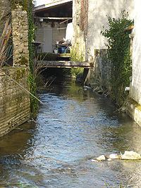
Map of La Boutonne, Courcelles, France

Départements and communes along its course

This list is ordered from source to mouth:

  • Deux-Sèvres: Chef-Boutonne, Fontenille-Saint-Martin-d'Entraigues, Chérigné, Lusseray, Brioux-sur-Boutonne, Vernoux-sur-Boutonne, Séligné, Brieuil-sur-Chizé, Villefollet, Villiers-sur-Chizé, Chizé, Le Vert
  • Charente-Maritime: Dampierre-sur-Boutonne, Saint-Séverin-sur-Boutonne, Coivert, Blanzay-sur-Boutonne, Saint-Georges-de-Longuepierre, Saint-Martial, Saint-Pierre-de-l'Isle, Nuaillé-sur-Boutonne, Saint-Pardoult, Les Églises-d'Argenteuil, Antezant-la-Chapelle, Vervant, Poursay-Garnaud, Courcelles, Saint-Julien-de-l'Escap, Saint-Jean-d'Angély, Ternant, La Vergne, Voissay, Torxé, Les Nouillers, Tonnay-Boutonne, Puy-du-Lac, Archingeay, Saint-Coutant-le-Grand, Champdolent, Lussant, Cabariot,
  • References

    Boutonne Wikipedia


    Similar Topics