
 | ||
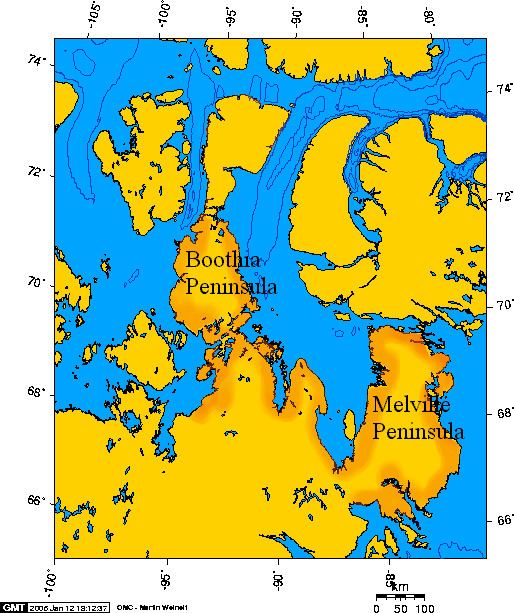
Boothia Peninsula (/ˈbuːθiə/; formerly Boothia Felix) is a large peninsula in Nunavut's northern Canadian Arctic, south of Somerset Island. The northern part, Murchison Promontory, is the northernmost point of mainland Canada.
Map of Boothia Peninsula, Kitikmeot, Unorganized, NU, Canada
Bellot Strait (Ikirahaq) separates the peninsula from Somerset Island to the north. Babbage Bay is on the east coast, as is Abernethy Bay, just to the south. The community of Taloyoak lies in the far south and is its only significant population centre. Paisley Bay is on the west coast, as is Wrottesley Inlet (between Paisley Bay and Bellot Strait).
John Ross was forced by ice to stop for four years at its easternmost point starting in 1829. He named it after his patron Sir Felix Booth. Ross encountered a large Inuit community whom he described as living in "snow cottages" (i.e. igloos) and immortalized in Ross's painting North Hendon[1]. In 1831 his nephew James Clark Ross went overland and reached the north magnetic pole which was then on its western side. He also crossed west to King William Island.
Both Roald Amundsen's first successful traverse of the Northwest Passage and Henry Larsen's second successful traverse of the Northwest Passage passed through the Bellot Strait. Larsen thought the strait too shallow for larger vessels, and described how his vessel was almost crushed by ice floes when there was a change in the wind's direction. On his return voyage Larsen passed north of Somerset Island.