
Population 223 (2011) Unitary authority Local time Monday 11:21 PM | OS grid reference SK985594 Sovereign state United Kingdom | |
 | ||
Weather 4°C, Wind W at 13 km/h, 78% Humidity UK parliament constituency | ||
Property video of village farm house for sale in boothby graffoe near lincoln
Boothby Graffoe is a village and civil parish in the North Kesteven district of Lincolnshire, England. The population of the civil parish at the 2011 census was 223. It is situated approximately 7 miles (10 km) south from the city and county town of Lincoln, and on the A607 Ermine Street Roman road.
Contents
- Property video of village farm house for sale in boothby graffoe near lincoln
- Map of Boothby Graffoe Lincoln UK
- References
Map of Boothby Graffoe, Lincoln, UK
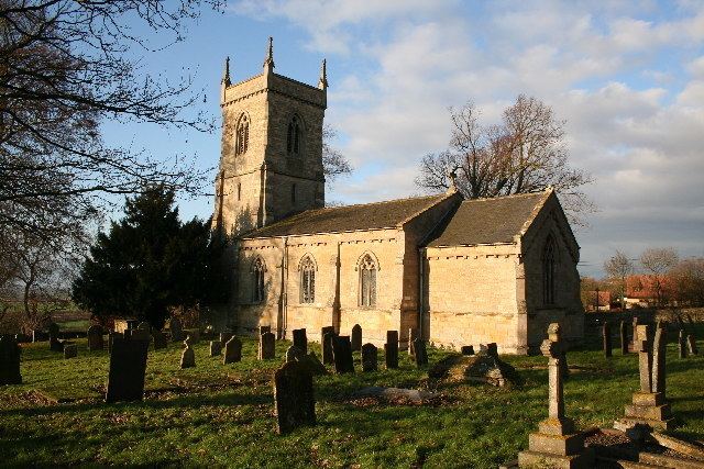
Boothby Graffoe Grade II listed Anglican parish church is dedicated to St Andrew The church was re-built in 1842. According to the parish registers of Wellingore, Boothby Graffoe's original church was destroyed by a hurricane in 1666.
To the west of the village lies the earthwork remains of Somerton Castle.
References
Boothby Graffoe Wikipedia(Text) CC BY-SA