
Elevation 980 m (3,220 ft) Lowest elevation 380 m (1,250 ft) Local time Monday 4:36 AM | Highest elevation 2,173 m (7,129 ft) Area 58.1 km² Postal code 28042 | |
 | ||
Weather 1°C, Wind W at 2 km/h, 80% Humidity Province | ||
Laghi monti terme di bognanco la valle della salute
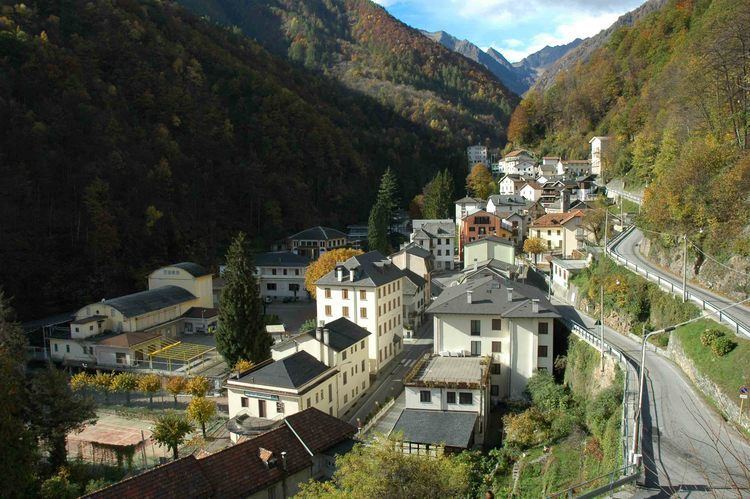
Bognanco, population about 250, is a commune in the Province of Verbano-Cusio-Ossola in the Italian region Piedmont, located in an Alpine valley about 120 kilometres (75 mi) northeast of Turin immediately to the west of Domodossola and on the border with Switzerland. Its municipal boundaries extend over an area of 58.1 square kilometres (22.4 sq mi) that ranges in elevation from 380 to 2,713 metres (1,247 to 8,901 ft) above sea-level and borders on the Italian communes of Antrona Schieranco, Crevoladossola, Domodossola, Montescheno and Trasquera, and Zwischbergen in the Swiss canton Valais.
Contents
- Laghi monti terme di bognanco la valle della salute
- Map of 28842 Bognanco Province of Verbano Cusio Ossola Italy
- Terme di bognanco 1931
- References
Map of 28842 Bognanco, Province of Verbano-Cusio-Ossola, Italy
The population is distributed between two main settlements, a number of hamlets, and various isolated dwellings: the seat of the municipality is in San Lorenzo (980 m). Fonti (669 m) was also classified as a centro abitato ("populated centre"). Less strongly defined settlements (nuclei abitati) were Graniga (1113 m), Messasca (525 m), and Pizzanco (1142 m). Localities whose population was subject to significant variation during the course of a year were Pioi (850 m), La Gomba (1251 m), and Vercengio (1299 m). Morasco (956 m) is described as a ‘special mountain nucleus’.