
0.6 250' contour 8.5 Crawle Halt | 0.2 Rio Cobre Bridge~40m 8.1 500' contour | |
 | ||
0.5 Bog Walk JunctionMainline from Spanish Town continues to Ewarton | ||
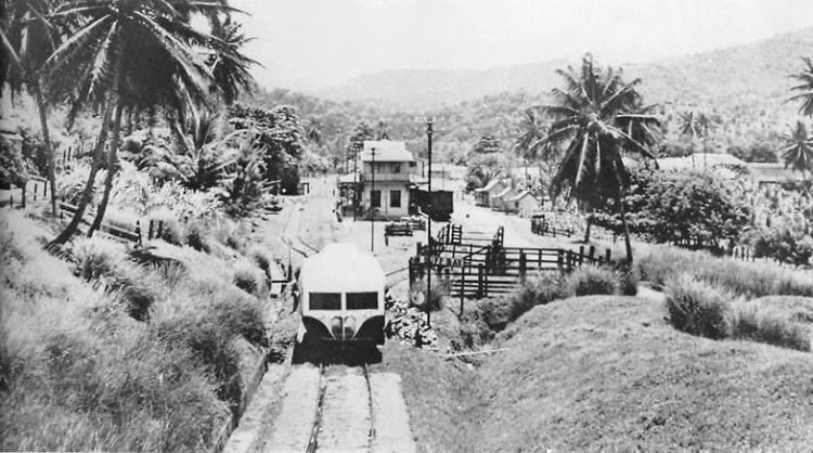
The Bog Walk to Port Antonio railway was a railway in Jamaica built to serve the banana, cacao, citrus and coconut districts of St Catherine, St Mary and Portland.
Contents
Construction, operation and closure
The railway operated from 1896 to 1978. It was temporarily closed from 1975 to 1977. The line was 54 miles (87 km) long.
Gradients
The ruling gradient was 1 in 63 with the line climbing approximately 550 feet (170 m) in 18 miles (29 km) (average gradient 1 in 173) from Bog Walk (approximately 250 feet (76 m)) to its summit at Highgate (approximately 800 feet (240 m)) then descending approximately 750 feet (230 m) in just 9 miles (14 km) (average gradient 1 in 63) to the Wag Water Bridge (just above sea level) and continuing for another 27 miles (43 km) more or less on the level and along the coast to Port Antonio.
Stations and Halts
There were 13 stations and 15 halts:
Tunnels
There were 17 tunnels:
Bridges
There were ten significant bridges. Approximate bridge lengths are shown in the route diagram to the right.