
Width 29 km (18 mi) Area 620 km² Elevation 387 m | Total islands 10 Highest elevation 387 m (1,270 ft) Concelhos (Municipalities) Boa Vista Max length 29 km Population 6,233 (2010) | |
 | ||
Points of interest Praia de Cabral, Chaminé de Chaves, Cabo de Santa Maria, Praia de Chaves | ||
Riu karamboa hotel boa vista cape verde islands
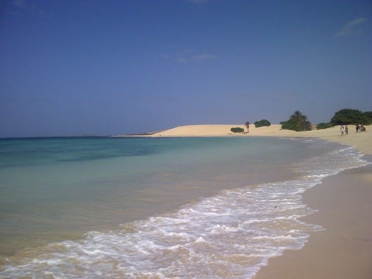
Boa Vista (Portuguese meaning “good view”) is the easternmost island of Cape Verde. It is located in the Barlavento group of the archipelago. The island is known for marine turtles and traditional music, as well as its ultramarathon and its sand dunes and beaches. The island also constitutes the municipality of Boa Vista, which has two parishes, Santa Isabel and São João Baptista.
Contents
- Riu karamboa hotel boa vista cape verde islands
- Map of Boa Vista Cape Verde
- Riu touareg boa vista cape verde 2016
- Etymology
- Geography
- Population
- Economy
- Politics
- Attractions and amenities
- Transportation
- Sporting teams
- Notable residents
- References
Map of Boa Vista, Cape Verde
Riu touareg boa vista cape verde 2016
Etymology
In the 19th century, the English called Boa Vista, Bonavisa.
Geography
With an area of 620 km², it is the third largest island, after Santo Antão and Santiago. It is 455 km west of the coast of Africa. Much of the island is flat. The highest point on the island is Monte Estância, elevation 387 meters; other mountains include Santo António (Saint Anthony) and Monte Negro (Black Mountain). Other features include Campo da Serra. Its main town is Sal Rei, its ferry port and home to Boa Vista's airport (Rabil Airport)on the northwest side of the island.
Surrounding islets include Ilhéu de Sal Rei featuring a lighthouse in the west, and Ilhéu do Baluarte featuring the easternmost point in Cape Verde. Points include Ponta Antónia to the north.
Population
As of the mid-19th century, the population was estimated at 4,000. While most of the population live in Sal Rei, there are many small settlements with 10 to 100 people; others are abandoned. It has the smallest population of all of inhabited Cape Verde’s islands, and it is the least-dense populated in the archipelago.
The population steadily grew up to the 1900s, drought and famine affected the population and many of the population immigrated in the final decades of Portuguese rule that started from the 1930s, the population grew around 10% each decade. Emigration dropped the population by over 150 between 1970 and 1980, in 1990, the population added only 80, the population started to rise large for the first time, after the end of the 20th century, the population was 4,209, nearly equal to the 19th century population, construction of hotels, villas and a stadium made a record breaking growth and reached 8,554 in 2010, an addition of over 100%, the estimate population has now reached over 10,000.
Economy
Its economy was originally based on agriculture, but desertification led to salt collection becoming more important. Its main industries today are date farming and, increasingly, tourism, with already several touristic establishments being built in recent times. As of July 2015, the island boasts the highest income per capita [i.e., US$8819,00] in the island nation.
Politics
The Camara Municipal is the main government institution of the island. The current President is José Pinto Almeida, MPD party.
At the federal level, it has two seats, in the 2011 elections, it had a PAICV and a MpD seat. In the 2016 elections, MpD won more than 80% in the island.
Boavista is twinned with the town of Zocca on May 9, 2014.
Attractions and amenities
Boa Vista has a college (colegio), a middle school, high school, churches, beaches, large hotels and a port which underwent expansion in the early to mid 2010s. Other hotels and villas had popped up in the west and south of the island, hotels and villas popped up in around 2004 west of Rabil and in 2009 in Curral Velho and connected them with newly paved roads.
Transportation
Since 2009, the island has 50.66 km of paved roads, 29.2 km are national and numbers 2 and 21.46 are municipal with four.
National highways