
County Dane ZIP 53517 Elevation 328 m Population 888 (2013) Area code 608 | State Wisconsin Time zone Central (CST) (UTC-6) FIPS code 55-08500 Area 236 ha Local time Sunday 5:31 AM | |
 | ||
Weather -1°C, Wind SE at 21 km/h, 94% Humidity | ||
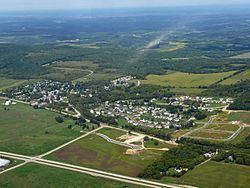
Blue Mounds is a village in Dane County, Wisconsin, United States. As of the 2010 census, the village had a population of 855. The village is adjacent to the Town of Blue Mounds, and is part of the Madison Metropolitan Statistical Area.
Contents
- Map of Blue Mounds WI 53517 USA
- Geography
- 2010 census
- 2000 census
- Recreation
- Attractions
- Notable residents and natives
- References
Map of Blue Mounds, WI 53517, USA
Blue Mounds was named by French missionaries for the blueish hue of three nearby mounds.
Geography
Blue Mounds is located 25 miles (40 km) west of Madison in Dane County near its border with Iowa County. The village is near Brigham Park, the Cave of the Mounds, and Blue Mound State Park, the highest point in southern Wisconsin.
According to the United States Census Bureau, the village has a total area of 0.91 square miles (2.36 km2), all of it land.
2010 census
As of the census of 2010, there were 855 people, 336 households, and 235 families residing in the village. The population density was 939.6 inhabitants per square mile (362.8/km2). There were 347 housing units at an average density of 381.3 per square mile (147.2/km2). The racial makeup of the village was 97.8% White, 0.1% African American, 0.4% Native American, 0.5% Asian, 0.5% from other races, and 0.8% from two or more races. Hispanic or Latino of any race were 1.3% of the population.
There were 336 households of which 34.8% had children under the age of 18 living with them, 56.5% were married couples living together, 6.0% had a female householder with no husband present, 7.4% had a male householder with no wife present, and 30.1% were non-families. 23.5% of all households were made up of individuals and 6% had someone living alone who was 65 years of age or older. The average household size was 2.54 and the average family size was 3.02.
The median age in the village was 39.8 years. 27.8% of residents were under the age of 18; 4.6% were between the ages of 18 and 24; 24.9% were from 25 to 44; 34% were from 45 to 64; and 8.7% were 65 years of age or older. The gender makeup of the village was 49.0% male and 51.0% female.
2000 census
As of the census of 2000, there were 708 residents, 289 occupied housing units, and 201 families residing in the village. The population density was 938.4 people per square mile (364.5/km²). There were 297 housing units at an average density of 393.6 per square mile (152.9/km²). The racial makeup of the village was 97.88% White, 0.42% Native American, 0.71% Asian, 0.14% from other races, and 0.85% from two or more races. 0.99% of the population were Hispanic or Latino of any race.
There were 289 households out of which 43.6% had children under the age of 18 living with them, 54.7% were married couples living together, 8.0% had a female householder with no husband present, and 30.4% were non-families. 24.9% of all households were made up of individuals and 7.3% had someone living alone who was 65 years of age or older. The average household size was 2.45 and the average family size was 2.90.
In the village, the population was spread out with 28.7% under the age of 18, 3.5% from 18 to 24, 39.3% from 25 to 44, 20.2% from 45 to 64, and 8.3% who were 65 years of age or older. The median age was 35 years. For every 100 females there were 98.3 males. For every 100 females age 18 and over, there were 101.2 males.
The median income for a household in the village was $45,568, and the median income for a family was $52,895. Males had a median income of $37,574 versus $25,188 for females. The per capita income for the village was $25,895. About 1.4% of families and 4.0% of the population were below the poverty line, including 1.9% of those under age 18 and 20.9% of those age 65 or over.
Recreation
The Military Ridge State Trail, a 39-mile (63 km) bicycle trail built on a former railroad right-of-way, runs through the village of Blue Mounds.
Each year the village is the starting point for the Horribly Hilly Hundreds bike ride along area roads that ends in a long, tough climb to the top of Blue Mound State Park. Riders can choose either a 100K or 200K course. The ride is held the Saturday before Father's Day.
In 2010 and 2011 Blue Mounds was a food stop on the 100K route for the annual Centurion race, which started and ended in Middleton, Wisconsin, allowing racers to get food as they pedaled through the area.
The Festival of the Mounds, which takes place at Mounds View Park each fall, includes a chicken wing cook-off, softball tournament, chicken barbecue, and live bands.
The Step Into The Past Rendezvous, sponsored by the Blue Mounds Are Historical Society, has been held each September, but has been run by a private group in recent years, as the Blue Mounds Area Historical Society is in hiatus. The rendezvous includes tepees, wall tents, a period weapons display, demonstrations of spinning and tanning, a tomahawk throw, and a candy cannon for children.
Each winter nearby Blue Mound State Park holds a Candlelight Ski and Hike the first Saturday in January and February.
Attractions
Local tourist attractions include Blue Mound State Park; the Cave of the Mounds, a National Natural Landmark; and Tyrol Basin Ski and Snowboard Area. The Blue Mounds Fort historical site is just south of the village but is not easily accessible.