
Population 6132 (2013) | ||
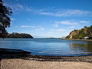 | ||
Blockhouse Bay is a residential suburb of Auckland, in New Zealand's North Island. It is sited on the northern coast of the Manukau Harbour, and is also close to the administrative boundary between Auckland City and Waitakere, two of the four cities of what was the Auckland conurbation.
Contents
Map of Blockhouse Bay, Auckland 0600, New Zealand
The suburb is located 11 kilometres to the southwest of the city centre, and is surrounded by the more central suburbs of Lynfield and New Windsor, and the Waitakere suburbs of New Lynn and Green Bay.
The Blockhouse Bay Library is located in the town centre, as is the Blockhouse Bay Community Centre, located 200 metres from the library.
According to the 2013 census, Blockhouse Bay has a population of 6132.
History
Portage Road is the location of one of the overland routes between the two harbours (and thus the Pacific Ocean and the Tasman Sea), where the Maori would beach their waka (canoes) and drag them overland to the other coast, thus avoiding having to paddle around North Cape. This made the area of immense strategic importance in both pre-European times and during the early years of European occupation.
The earliest European known to have trekked through, and followed the coastline of the Manukau Harbour in an endeavour to find if there was a waterway connecting the two harbours, was the Rev. Samuel Marsden in 1820.
Two missionaries who had arrived in New Zealand on 30 December 1834, William Colenso and R. Wade, walked through the Whau South area in 1838 hoping to find a Māori settlement, but the Pa site on Te Whau point had been abandoned some time before. They remarked that the area was "open and barren heaths, dreary, sterile and wild."
The area was a popular holiday resort in the 1920s for Aucklanders, with families making the journey over rough roads to spend the summer at the beach.
The earliest industry, in 1884, was the Gittos Tannery. The early 1900s saw other industries such as poultry, orchards, potteries, strawberries, flowers, loganberries and small farm holdings.
The building which eventually gave the name to the area was constructed in 1860. At this time the Land War in Taranaki was escalating and there were fears it would spread north and so a defence system for Auckland was actioned. A 12-acre site was chosen, bordered by Esplanade (Endeavour Street), Gilfillan Street, Wynyard Road (Blockhouse Bay Road) and Boylan Street (Wade Street). The actual Whau Blockhouse was located on what is now No. 8 Gilfillan Street.
The site was chosen for two reasons:
Colonel Thomas Mould of the Royal Engineers was charged with planning the location and type of defence system needed. A blockhouse is a purpose-built building with walls thick enough to stop musket ball penetration, with slits in the walls for defensive musket fire, a fence or stockade surrounding the building, with a trench beyond that. The Blockhouse Bay Blockhouse never saw military action. In the 1880s it was rented out to a tenant and was gutted in a fire. It was subsequently demolished. The trenches were apparently still visible in the 1940s but have since been obsured.
Education
Local Primary Students attend Blockhouse Bay Primary, Chaucer Primary, St. Dominics Primary and Marshall Laing Primary School. Until December 2009, a private school named Hilltop School also existed in Blockhouse Bay.
Local Intermediate Students attend Blockhouse Bay Intermediate School
Local secondary students attend Lynfield College, Mount Roskill Grammar School, Green Bay High School, Marcellin College or Auckland International College.
Sport and recreation
The Bay Roskill Vikings rugby league club are based at Blockhouse Bay reserve.