
Population 3,936 (2006) | Southeast (Manukau Harbour) Southwest Wood Bay Northwest Titirangi North | |
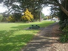 | ||
Green Bay is an Auckland suburb. It is under the local governance of the Auckland Council. The population was 3,936 in the 2006 Census, an increase of 321 from 2001. The main road running through Green Bay is Godley Road and this is the Urban Route 15 that follows through Green Bay to Titirangi and Laingholm.
Contents
Map of Green Bay, Auckland 0604, New Zealand
Green Bay beach is part of the Karaka Park coastal walk. In pre-European times, the beach was the southern end of a portage between the Waitemata and Manukau harbours via the Whau River. At the west end of the beach there was a large Māori pā at Motukaraka (which is today Karaka Park). The area was originally called Karaka Bay, but was renamed to the current name to avoid confusion with other bays named Karaka.
Education
Green Bay High School is a secondary (years 9-13) school with a decile rating of 8 and a roll of 1467. It opened in 1972.
Green Bay Primary School is a full primary (years 1-8) school with a decile rating of 7 and a roll of 594. It opened in 1960, and covered years 1-6 until an intermediate department was added in 1987.
Both schools are coeducational, and situated next to each other on Godley Road.