
Opening date 1950 Surface area 254 acres (1.03 km²) Opened 1950 Catchment area 91,168 km² Construction began 1948 | Height 21 m Length 187 m | |
 | ||
Total capacity 11,000 acre feet (14,000,000 m) Similar Snake River, Lower Salmon Falls Dam, C J Strike Dam, Oxbow Dam, Brownlee Dam | ||
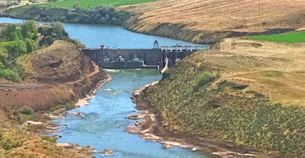
Bliss Dam is a concrete gravity-type hydroelectric dam on the Snake River, in the U.S. state of Idaho. The dam is located near Bliss, Idaho.
Map of Bliss Dam, Bliss, ID 83314, USA
Along with the Upper Salmon Falls and Lower Salmon Falls dam projects, Bliss Dam is part of Idaho Power Company's Mid-Snake Projects. The Mid-Snake Projects in total have a nameplate capacity of 169.5 MW.
References
Bliss Dam Wikipedia(Text) CC BY-SA