
Traversed by US 97 Road U.S. Route 97 | Elevation 1,250 m | |
 | ||
Similar | ||
S2e12 washington state gold mining blewett pass area the old river bed wth pete
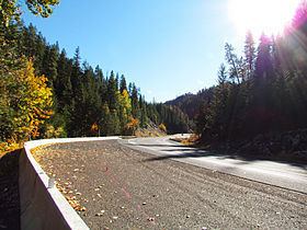
Blewett Pass, at an elevation of 4,124 feet (1,257 m), is a mountain pass in the Wenatchee Mountains (an eastward extension of the Cascades) of Washington state that is crossed by U.S. Route 97 (US 97). Named for Edward Blewett, a Seattle mining promoter of the 1880s, it lies on the route of the historical Yellowstone Trail.
Contents
- S2e12 washington state gold mining blewett pass area the old river bed wth pete
- Map of Blewett Pass Washington 98922 USA
- References
Map of Blewett Pass, Washington 98922, USA
Unlike the many well known passes that lie on the spine of the Cascades, Blewett Pass lies on the divide between the Wenatchee River to the north and the Yakima River to the south. The highway over the pass connects Interstate 90 (I-90) between Seattle and Ellensburg, Washington with US 2 between Monroe and Wenatchee. The route from Seattle to Wenatchee over Snoqualmie Pass and Blewett Pass is a reasonable alternative to the more northerly route over Stevens Pass.
What is now called Blewett Pass was formerly known as Swauk Pass. It should not be confused with Old Blewett Pass, which is about 5 miles (8.0 km) west of the current summit at the slightly lower elevation of 4,064 feet (1,239 m). The old pass road is Forest Road 9715 and Forest Road 7320. The road closes for the winter so that seasonal recreation may take place. Notify the Forest Service in the Wenatchee National Forest before taking the road upon re-opening in the warmer months.