
Width 135m | Length 365m Height 110m Excavation dates 1947-49 & 1968-1969 | |
 | ||
Similar Wittenham Clumps, Wayland's Smithy, Cerne Abbas Giant, Uffington White Horse, Silbury Hill | ||
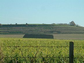
Blewburton Hill is the site of an Iron Age hill fort located in Oxfordshire. It is described as an irregular oval fort of about 365m by 135m enclosed by a single ditch and rampart, although maps and photographs clearly show at least 4 ditches and ramparts on the Western side. The area is mostly farmland with some small areas of wooded copse to the south and the northeast. The hill fort may have been occupied from the 4th century BC to the 1st century BC, and replaced the original stockaded camp on the site, built in the 5th or 6th century BC. Archaeological excavations were undertaken at the site between 1947 and 1949.
Contents
Map of Blewburton Hill, Didcot, UK
Location
The site is located at grid reference SU546861, and lies immediately to the west of the village of Aston Tirrold, and to the east of the village of Blewbury, in the county of Oxfordshire. The hill has a summit of 110m AOD.