
Postal code 9685 | ||
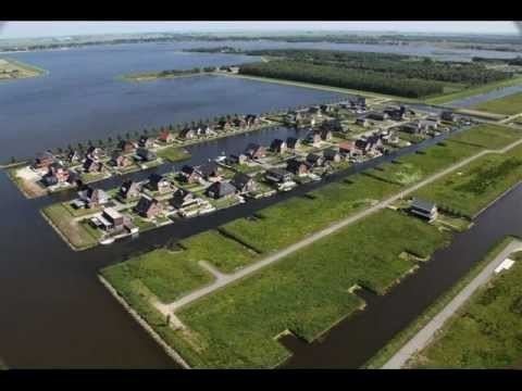 | ||
Blauwestad ( [ˌblʌuʋəˈstɑt]) is a village in the municipality of Oldambt in the Netherlands. It is situated on the east bank of the Oldambtmeer in the east of the province of Groningen.
Contents
Map of Blauwestad, Netherlands
History
After the Oldambtmeer was created in 2005, the village of Blauwestad (English: Blue City) started to be developed. The first inhabitants settled in the village in 2006.
Geography
Blauwestad is located at 53°10′N 07°02′E in the municipality of Oldambt in the east of the province of Groningen in the northeast of the Netherlands. Blauwestad is north of Winschoten, east of Scheemda, southeast of Midwolda, south of Oostwold, southwest of Finsterwolde, and west of Beerta. It was created in and on the eastern bank of the artificial lake Oldambtmeer.
References
Blauwestad Wikipedia(Text) CC BY-SA