
Elevation AMSL 356 ft / 109 m 5,152 1,570 Elevation 109 m | 12/30 5,152 1,570 Asphalt Phone +1 334-445-5045 | |
 | ||
Similar Dothan Regional Airport, Cairns Aaf Fort Rucker, URS Corporati, Lowe Army Heliport, US Army Aviation Museum | ||
Eagle aviation ozark al blackwell pam and eli s first helicopter flight blackwell field k71j
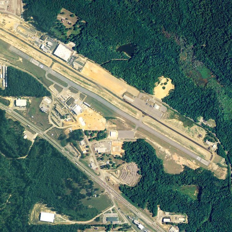
Blackwell Field (FAA LID: 71J) is a public-use airport located two nautical miles (2.3 mi, 3.7 km) southeast of the central business district of Ozark, in Dale County, Alabama, United States. The airport is owned by the Town of Ozark. It is included in the FAA's National Plan of Integrated Airport Systems for 2011–2015, which categorized it as a general aviation facility.
Contents
- Eagle aviation ozark al blackwell pam and eli s first helicopter flight blackwell field k71j
- Facilities and aircraft
- References
Facilities and aircraft
Blackwell Field covers an area of 114 acres (46 ha) at an elevation of 356 feet (109 m) above mean sea level. It has one runway designated 12/30 with an asphalt surface measuring 5,152 by 80 feet (1,570 x 24 m).
For the 12-month period ending March 4, 2010, the airport had 91,500 general aviation aircraft operations, an average of 250 per day. At that time there were 26 aircraft based at this airport: 58% single-engine, 15% multi-engine, 4% jet and 23% helicopter.