
Traversed by Unpaved road | Elevation 3,914 m | |
 | ||
Similar Imogene Pass, Bridal Veil Falls, Red Mountain Pass, Rocky Mountains, San Juan Mountains | ||
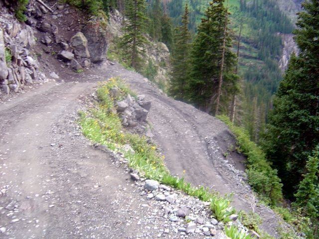
Black Bear Road, officially Forest Service Road 648, is a notorious jeep trail that starts from 11,018-foot (3,358 m) summit of Red Mountain Pass on U.S. Highway 550 (between Ouray and Silverton) to Telluride, Colorado. The Black Bear Road crests at Black Bear Pass, elevation 12,840 feet (3,910 m). The road descends over a set of infamous switchbacks as it navigates the heights above Telluride. The road passes Bridal Veil Falls, the second highest waterfall in Colorado. The road was made famous in a spoken word song by C.W. McCall of the same name.
Contents
Map of Black Bear Road, Colorado 81435, USA
Black Bear Road is open a few months of the year, from late summer (usually the last week of July) to early fall. The road is traveled only downhill from Red Mountain Pass — except for the annual Jeeper's Jamboree in which travel is reversed for one day only. The start of the trail is marked along U.S. 550 with the famous sign that reads:
In popular cultureEdit
"Black Bear Road" song from Black Bear Road (album) is also the name of the C.W. McCall album which contains the song that made the road famous.