
Biswanath 2015 Elevation 48 m (157 ft) Area 1,100 km² | Time zone IST (UTC+5:30) | |
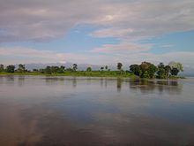 | ||
Biswanath (IPA: ˌbɪswəˈnɑːθ ˈtʃɑːrɪˌælɪ) (Assamese: বিশ্বনাথ জিলা ) is an administrative district in the state of Assam in India. It is one of newly created district in the year by 2015, declared by Assam Chief Minister on 15 August 2015. The district is created amalgamating Gohpur and most part of Biswanath Sub division on earlier Sonitpur district . The district is bounded by Arunachal Pradesh district on north, Golaghat, Brahmaputra on the south, Lakhimpur district on the east and Sonitpur district on the west. The administrative headquarter is located at Biswanath Chariali.
Contents
Map of Biswanath Town, Assam 784177
Administration
References
Biswanath district Wikipedia(Text) CC BY-SA