
Elevation 4,153 m First ascent 18 August 1884 | Easiest route North-west flank, (F) Prominence 120 m | |
 | ||
Isolation 0.8 kilometres (0.50 mi) Similar | ||
Bishorn besteigung 4 153m 2014 full hd
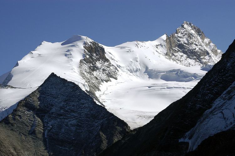
The Bishorn (4,153 m) is a mountain in the Pennine Alps in Switzerland, just north of the Weisshorn.
Contents
- Bishorn besteigung 4 153m 2014 full hd
- Map of Bishorn 3928 Oberems Switzerland
- Bishorn 2016
- HutsEdit
- Access roadsEdit
- References
Map of Bishorn, 3928 Oberems, Switzerland
The mountain has two distinct summits, separated by a 600-metre easy-angled snow ridge.
Bishorn 2016
HutsEdit
Huts serving the peak are the Cabane de Tracuit (3,256 m) and the Turtmann hut (2,519 m).
Access to both huts is snow-free in summertime. The Tracuit hut is normally accessed from the Zinal valley, a long and demanding walk of around five hours from the village to the hut.
The Turtmann hut is primarily used for climbing the Barrhorn and the Brunegghorn. Note that climbing the Bishorn from the Turtmann hut requires a far longer glacier walk through sections with numerous crevasses.
Access roadsEdit
The access roads to the huts are from the Rhone valley in the north. The road to Zinal starts at Sierre, and the other road starts from Turtmann village. In both cases these are good and attractive mountain roads typical of the area.