
Vehicle registration RE Area 30.6 km² Local time Wednesday 9:26 AM Area code 05674 | Time zone CET (UTC+1) Elevation 1,079 m Population 809 (1 Apr 2009) Postal code 6621 | |
 | ||
Website www.riskommunal.net/bichlbach Weather 0°C, Wind W at 10 km/h, 73% Humidity | ||
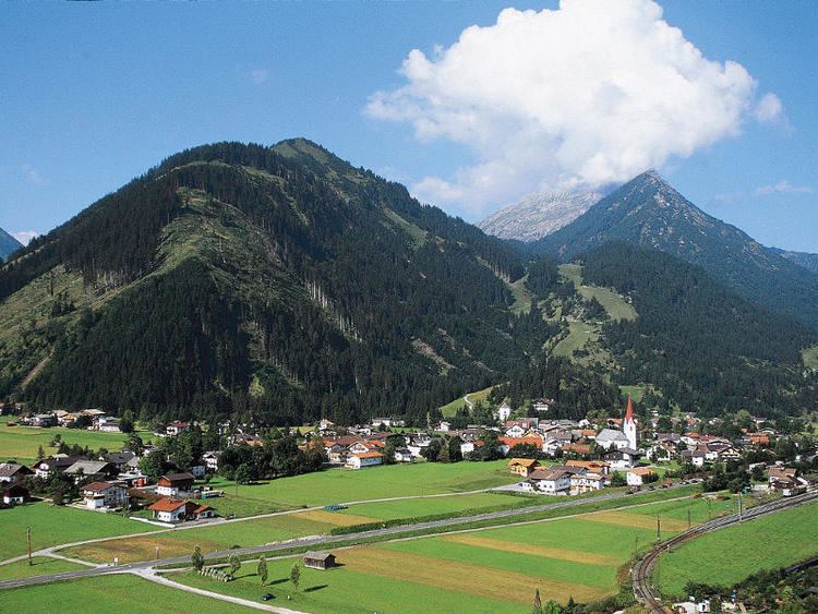
Bichlbach 2015
Bichlbach is a municipality in the district of Reutte in the Austrian state of Tyrol.
Contents
- Bichlbach 2015
- Map of 6621 Bichlbach Austria
- Dalafdaling berwang naar bichlbach 20 januari 2014
- Geography
- References
Map of 6621 Bichlbach, Austria
Dalafdaling berwang naar bichlbach 20 januari 2014
Geography
Bichlbach lies at an elevation of 1,079 m (AA) in the Zwischentoren, the valley that links the Ehrwald Basin with the Lech valley. Over the municipal territory runs the watershed between the Lech and Loisach. The municipality consists of three villages: the elongated Straßendorf of Bichlbach (1,079 m (AA), population: 550) and the two almost adjacent villages of Lähn (1,112 m (AA), pop: 225) and Wengle (1,083 m (AA), pop: 76; population figures as at 15 May 2001). Bichlbach is the base for an ascent of the Kohlbergspitze (2,202 m) on a waymarked path that takes around 3 hours.
References
Bichlbach Wikipedia(Text) CC BY-SA