
 | ||
Similar | ||
According to the Book of Exodus, Mount Sinai (Hebrew: הר סיני, Har Sinai) is the mountain at which the Ten Commandments were given to Moses by God. In the Book of Deuteronomy, these events are described as having transpired at Mount Horeb. "Sinai" and "Horeb" are generally considered to refer to the same place, although there is a small body of opinion that the two names may refer to different locations.
Contents
- Etymology
- Other names
- Biblical description
- Critical views
- Suggested locations
- Sinai Peninsula
- EdomNabatea
- Saudi Arabia
- The Negev
- References
Hebrew Bible texts describe the theophany at Mount Sinai in terms which a minority of scholars, following Charles Beke (1873), have suggested may literally describe the mountain as a volcano and have led to a search for alternative locations.
Etymology
According to the Documentary hypothesis, the name "Sinai" is only used in the Torah by the Jahwist and Priestly source, whereas Horeb is only used by the Elohist and Deuteronomist.
According to some biblical scholars, Horeb is thought to mean "glowing/heat", which seems to be a reference to the sun, while Sinai may have derived from the name of Sin, the Sumerian deity of the moon, and thus Sinai and Horeb would be the mountains of the moon and sun, respectively.
Regarding the Sumerian Sin deity assumption, William F. Albright, an American biblical scholar, had stated:
...there is nothing that requires us to explain Him as a modified moon-god. It is improbable that the name Sinai is derived from that of the Sumerian Zen (older Zu-en), Akkadian Sin, the moon-god worshiped at Ur (in his form Nannar) and at Harran, since there is no indication that the name Sin was ever employed by the Canaanites or the Semitic nomads of Palestine.
It is much more likely that the name Sinai is connected with the place-name Sin, which belongs to a desert plain in Sinai as well as to a Canaanite city in Syria and perhaps to a city in the northeast Delta of Egypt. It has also been recognized that it may somehow be connected with seneh (Aram. sanya), the name of a kind of bush where Moses is said to have first witnessed the theophany of Yahweh.
According to Rabbinic tradition, the name "Sinai" derives from sin-ah (שִׂנְאָה), meaning hatred, in reference to the other nations hating the Jews out of jealousy, due to the Jews being the ones to receive the word of God.
Other names
Classical rabbinic literature mentions the mountain having other names:
Also:
Biblical description
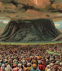
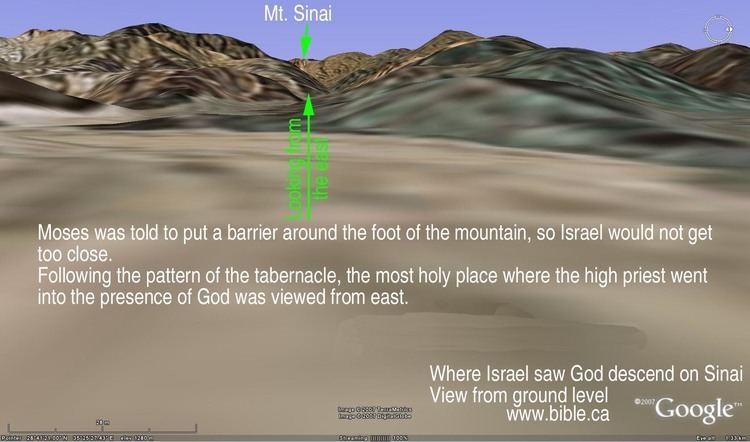
According to the biblical account of the giving of the instructions and teachings of both the Written and the Oral Torah, Sinai was enveloped in a cloud, it quaked and was filled with smoke, while lightning-flashes shot forth, and the roar of thunder mingled with the blasts of a trumpet; the account later adds that fire was seen burning at the summit of the mountain. In the biblical account, the fire and clouds are a direct consequence of the arrival of God upon the mountain. According to the biblical story, Moses departed to the mountain and stayed there for 40 days and nights in order to receive the Ten Commandments, the Written and the Oral Torah, and he did so twice because he broke the first set of the tablets of stone after returning from the mountain for the first time.
The biblical description of God's descent seems to be in conflict with the statement shortly after that God spoke to the Israelites from Heaven. While biblical scholars argue that these passages are from different sources, the Mekhilta argues that God had lowered the heavens and spread them over Sinai, and the Pirke De-Rabbi Eliezer argues that a hole was torn in the heavens, and Sinai was torn away from the earth and the summit pushed through the hole. 'The heavens' could be a metaphor for clouds and the 'lake of fire' could be a metaphor for the lava-filled crater. Several bible criticsWho? have indicated that the smoke and fire reference from the Bible suggests that Mt Sinai was a volcano; despite the absence of ash. Other bible scholars have suggested that the description fits a storm especially as the Song of Deborah seems to allude to rain having occurred at the time. The biblical record notes the uniqueness of the event by stating that God spoke directly to the Israelite nation as a whole.
Critical views
Some modern biblical scholars explain Mount Sinai as having been a sacred place dedicated to one of the Semitic deities, even before the Israelites encountered it. Others regard the set of laws given on the mountain to have originated in different time periods from one another, with the later ones mainly being the result of natural evolution over the centuries of the earlier ones, rather than all originating from a single moment in time.
Suggested locations
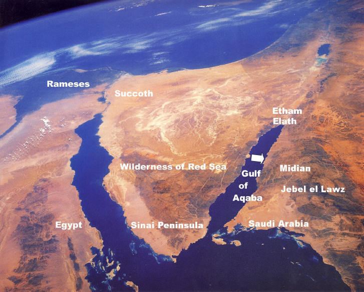
Modern scholars differ as to the exact geographical position of Mount Sinai, and the same has long been true of scholars of Judaism. The Elijah narrative appears to suggest that when it was written, the location of Horeb was still known with some certainty, as Elijah is described as travelling to Horeb on one occasion, but there are no later biblical references to it that suggest the location remained known; Josephus only specifies that it was within Arabia Petraea (a Roman Province encompassing modern Jordan, southern modern Syria, the Sinai Peninsula and northwestern Saudi Arabia with its capital in Petra), and the Pauline Epistles are even more vague, specifying only that it was in Arabia, which covers most of the south-western Middle east.
Sinai Peninsula
The earliest references to Jebel Musa as Mount Sinai or Mount Sinai being located in the present day Sinai Peninsula are inconclusive. There is evidence that prior to 100 CE, well before the Christian monastic period, Jewish sages had already identified Jebel Musa as Mount Sinai. Graham Davies of Cambridge University offers evidence that early Jewish pilgrimages had already identified Jebel Musa as Mount Sinai and this identification was later adopted by the Christian pilgrims. R. K. Harrison states that, “Jebel Musa . . . seems to have enjoyed special sanctity long before Christian times, culminating in its identification with Mt. Sinai." In the second and third centuries BCE Nabataeans were making pilgrimages there, which is indicated in part by inscriptions discovered in the area.
Josephus wrote that "Moses went up to a mountain that lay between Egypt and Arabia, which was called Sinai." Josephus says that Sinai is "the highest of all the mountains thereabout," and is "the highest of all the mountains that are in that country, and is not only very difficult to be ascended by men, on account of its vast altitude but because of the sharpness of its precipices". The traditional Mount Sinai, located in the Sinai Peninsula, is actually the name of a collection of peaks, sometimes referred to as the Holy Mountain peaks which consist of Jebel Musa, Mount Catherine and Ras Sufsafeh. Etheria (circa 4th century CE) wrote, "The whole mountain group looks as if it were a single peak, but, as you enter the group, [you see that] there are more than one." The highest mountain peak is Mount Catherine, rising 2,610 metres (8,550 feet) above the sea and its sister peak, Jebel Musa (2,250 m [7,370 ft]), is not much further behind in height, but is more conspicuous because of the open plain called er Rachah ("the wide"). Mount Catherine and Jebel Musa are both much higher than any mountains in the Sinaitic desert, or in all of Midian. The highest tops in the Tih desert to the north are not much over 1,200 m (4,000 ft). Those in Midian, East of Elath, rise only to 1,300 m (4,200 ft). Even Jebel Serbal, 30 kilometres (20 mi) west of Sinai, is at its highest only 2,050 m (6,730 ft) above the sea.
Some scholars believe that Mount Sinai was of ancient sanctity prior to the ascent of Moses described in the Bible. Scholars have theorized that Sinai in part derived its name from the word for moon which was "sin" (meaning "the moon" or "to shine"). Antoninus Martyr provides some support for the ancient sanctity of Jebel Musa by writing that Arabian heathens were still celebrating moon feasts there in the 6th century. Lina Eckenstien states that some of the artifacts discovered indicate that "the establishment of the moon-cult in the peninsula dates back to the pre-dynastic days of Egypt." She says the main center of moon worship seems to have been concentrated in the southern Sinai peninsula which the Egyptians seized from the Semitic people who had built shrines and mining camps there. Robinson says that inscriptions with pictures of moon worship objects are found all over the southern peninsula but are missing on Jebel Musa and Mount Catherine which oddity may suggest religious cleansing.
Groups of nawamis have been discovered in southern Sinai, creating a kind of ring around Jebel Musa. The nawamis were used over and over throughout the centuries for various purposes. Etheria, circa the 4th/5th century CE, noted that her guides, who were the local "holy men", pointed out these round or circular stone foundations of temporary huts, claiming the children of Israel used them during their stay there.
The southern Sinai Peninsula contains archaeological discoveries but to place them with the exodus from Egypt is a daunting task inasmuch as the proposed dates of the Exodus vary so widely. The Exodus has been dated from the Early Bronze Age to the Late Iron Age II with most fundamentalists pointing toward the late Bronze Age.
Egyptian pottery in the southern Sinai during the Late Bronze and Early Iron I (Ramesside) periods has been discovered at the mining camps of Serabit el-Khadim and Timna. Objects which bore Proto-Sinaitic inscriptions, the same as those found in Canaan, were discovered at Serabit el Khadim in the Southern Sinai. Several of these were dated in the later Bronze Age. These encampments provide evidence of miners from southern Canaan. The remote site of Serabit el-Khadem was used for a few months at a time, every couple of years at best, more often once in a generation. The journey to the mines was long, difficult and dangerous. Expeditions headed by Professor Mazar examined the tell of Feiran, the principal oasis, of southern Sinai and discovered the site abounded not only in Nabatean sherds but in wheel-burnished sherds typical of the Kingdom of Judah, belonging to Iron Age II.
Edward Robinson insisted that the Plain of ar-Raaha adjacent to Jebel Musa could have accommodated the Israelites. Edward Hull stated that, "this traditional Sinai in every way meets the requirements of the narrative of the Exodus." Hull agreed with Robinson and stated he had no further doubts after studying the great amphitheater leading to the base of the granite cliff of Ras Sufsafeh, that here indeed was the location of the camp and the mount from which the laws of God was delivered to the encampment of Israelites below.
F. W. Holland stated (Recovery of Jerusalem, 524): "With regard to water-supply there is no other spot in the whole Peninsula which is nearly so well supplied as the neighborhood of Jebel Musa . . . There is also no other district in the Peninsula which affords such excellent pasturage."
Calculating the travels of the Israelites, the Bible Atlas states, "These distances will not, however, allow of our placing Sinai farther East than Jebel Musa."
Some point to the absence of material evidence left behind in the journey of the Israelites but Dr. Beit-Arieh wrote, "Perhaps it will be argued, by those who subscribe to the traditional account in the Bible, that the Israelite material culture was only of the flimsiest kind and left no trace. Presumably the Israelite dwellings and artifacts consisted only of perishable materials." Hoffmeier wrote, "None of the encampments of the wilderness wanderings can be meaningful if the Israelites went directly to either Kadesh or Midian ... a journey of eleven days from Kadesh to Horeb can be properly understood only in relationship to the southern portion of the Sinai Peninsula."
Local Bedouins who have long inhabited the area have identified Jebel Musa as Mount Sinai. In the fourth century CE small settlements of monks set up places of worship around Jebel Musa. An Egyptian pilgrim named Ammonius, who had in past times made various visits to the area, identified Jebel Musa as the Holy Mount in the 4th century. Empress Helena, ca. 330 CE, built a church to protect monks against raids from nomads. She chose the site for the church from the identification which had been handed down through generations through the Bedouins. She also reported the site was confirmed to her in a dream.
The Sinai peninsula has traditionally been considered Sinai's location by Christians, although it should also be noted that the peninsula gained its name from this tradition, and was not called that in Josephus' time or earlier. (The Sinai was earlier inhabited by the Monitu and was called Mafkat or Country of Turquoise.) In early Christian times, a number of Anchorites settled on Mount Serbal, considering it to be the biblical mountain, and in the 4th century a monastery was constructed at its base. Nevertheless, Josephus had stated that Mount Sinai was "the highest of all the mountains thereabout", which would imply that Mount Catherine was actually the mountain in question, if Sinai was to be sited on the Sinai peninsula at all. In the 6th century, Saint Catherine's Monastery was constructed at the base of this mountain, leading to the abandonment of the monastery at Serbal, and two monks, allegedly in 300 CE, claimed that one of the bushes in the monastic grounds was the biblical burning bush, and according to monastic tradition this bush still survives (rather than another having grown in its place).
Unlike these Christian traditions, Bedouin tradition considered Jabal Musa, which lies adjacent to Mount Catherine, to be the biblical mountain, and it is this mountain that local tour groups and religious groups presently advertise as the biblical Mount Sinai. Evidently this view was eventually taken up by Christian groups as well, as in the 16th century a church was constructed at the peak of this mountain, which was replaced by a Greek Orthodox chapel in 1954.
According to textual scholars, in the JE version of the Exodus narrative, the Israelites travel in a roughly straight line to Kadesh Barnea from the Yam Suph (literally meaning "the Reed Sea", but considered traditionally to refer to the Red sea), and the detour via the south of the Sinai peninsula is only present in the Priestly Source. A number of scholars and commentators have therefore looked towards the more central and northern parts of the Sinai peninsula for the mountain. Mount Sin Bishar, in the west-central part of the peninsula, was proposed to be the biblical Mount Sinai by Menashe Har-El, a biblical geographer at Tel Aviv University. Mount Helal, in the north of the peninsula has also been proposed. Another northern Sinai suggestion is Hashem el-Tarif, some 30 km west of Eilat, Israel.
Edom/Nabatea
Since Moses is described by the Bible as encountering Jethro, a Kenite who was a Midianite priest, shortly before encountering Sinai, this suggests that Sinai would be somewhere near their territory in Saudi Arabia; the Kenites and Midianites appear to have resided east of the Gulf of Aqaba. Additionally, the Song of Deborah, which some textual scholars consider one of the oldest parts of the Bible, portrays God as having dwelt at Mount Seir, and seems to suggest that this equates with Mount Sinai; Mount Seir designates the mountain range in the centre of Edom.
Based on a number of local names and features, in 1927 Ditlef Nielsen identified the Jebel al-Madhbah (meaning mountain of the Altar) at Petra as being identical to the biblical Mount Sinai; since then other scholars have also made the identification.
The valley in which Petra resides is known as the Wadi Musa, meaning valley of Moses, and at the entrance to the Siq is the Ain Musa, meaning spring of Moses; the 13th century Arab chronicler Numari stated that Ain Musa was the location where Moses had brought water from the ground, by striking it with his rod. The Jebel al-Madhbah was evidently considered particularly sacred, as the well known ritual building known as The Treasury is carved into its base, the mountain top is covered with a number of different altars, and over 8 metres of the original peak were carved away to leave a flat surface with two 8 metre tall obelisks sticking out of it; these obelisks, which frame the end of the path leading up to them, and are now only 6 metres tall, have led to the mountain being colloquially known as Zibb 'Atuf, meaning penis of love in Arabic. Archaeological artifacts discovered at the top of the mountain indicate that it was once covered by polished shiny blue slate, fitting with the biblical description of paved work of sapphire stone; biblical references to sapphire are considered by scholars to be unlikely to refer to the stone called sapphire in modern times, as sapphire had a different meaning, and wasn't even mined, before the Roman era. Unfortunately, the removal of the original peak has destroyed most other archaeological remains from the late Bronze Age (the standard dating of the Exodus) that might previously have been present.
Saudi Arabia
A suggested possible naturalistic explanation of the biblical devouring fire is that Sinai could have been an erupting volcano; this has been suggested by Charles Beke, Sigmund Freud, and Immanuel Velikovsky, among others. This possibility would exclude all the peaks on the Sinai peninsula and Seir, but would make a number of locations in north western Saudi Arabia reasonable candidates. In 1873, Charles Beke proposed that Sinai was the Jabal al-Nour (meaning mountain of light), a volcanic mountain at the northern end of the Gulf of Aqaba, and which has great significance in Islam for other reasons; Beke died during the following year, but his writings (published posthumously) retracted this identification four years later in favour of Jebel Baggir, with Horeb being argued to be a different mountain - the nearby Jebel Ertowa. Beke's suggestions have not found as much scholarly support as the candidature of Hala-'l Badr; the equation of Sinai with Hala-'l Badr has been advocated by Alois Musil in the early 20th century, Jean Koenig in 1971, and Colin Humphreys in 2003, among others.
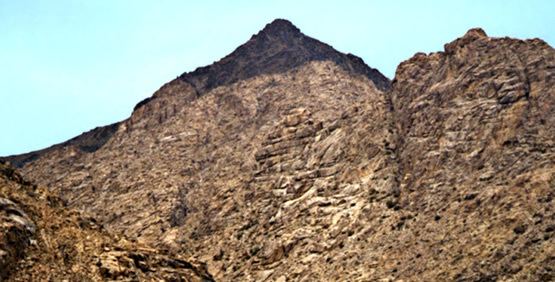
The possibility of an alternate site located in Saudi Arabia has also drawn attention due to the Apostle Paul's assertion in the first century that Mount Sinai was located in Arabia, although in Paul's time, the region of Arabia Petraea would have included both the modern Sinai peninsula and northwestern Saudi Arabia. A possible candidate within the Arabia theory has been that of Jabal al-Lawz (meaning 'mountain of almonds'). Advocates for Jabal al-Lawz include Lennart Moller (a Swedish professor in environmental medicine) and also Ron Wyatt and Bob Cornuke. Allen Kerkeslager, associate professor of Theology at St. Joseph's University believes that the archaeological evidence is too tenuous to draw conclusions but has stated that "Jabal al Lawz may also be the most convincing option for identifying the Mt. Sinai of biblical tradition" and should be researched. A number of researchers support this hypothesis while others dispute it.
Jabal al-Lawz has been rejected by scholars such as James K. Hoffmeier (Professor of Old Testament and Ancient Near Eastern History and Archaeology) who details what he calls Cornuke's "monumental blunders" and others. Gordon Franz, a professional researcher, has studied this topic in depth and has published a refutation of this hypothesis.
Although Jabal al-Lawz has drawn considerable debate as a possible candidate, the broader Arabia hypothesis as a region in which Mount Sinai is located continues to draw attention.
The Negev
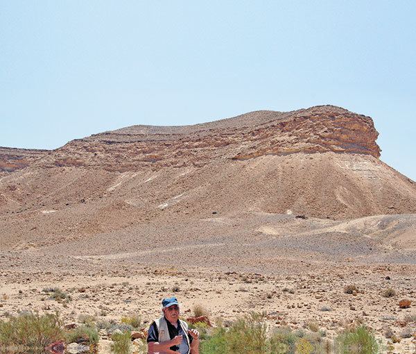
While equating Sinai with Petra would indicate that the Israelites journeyed in roughly a straight line from Egypt via Kadesh Barnea, and locating Sinai in Saudi Arabia would suggest Kadesh Barnea was skirted to the south, some scholars have wondered whether Sinai was much closer to the vicinity of Kadesh Barnea itself. Half way between Kadesh Barnea and Petra is Har Karkom, which Emmanuel Anati excavated, and discovered to have been a major Paleolithic cult centre, with the surrounding plateau covered with shrines, altars, stone circles, stone pillars, and over 40,000 rock engravings; although the peak of religious activity at the site dates to 2350-2000 BCE, the exodus is dated 15 Nisan 2448 (Hebrew calendar; 1313 BCE), and the mountain appears to have been abandoned between 1950-1000 BCE, Anati proposed that Jabal Idead was equatable with biblical Sinai. Other scholars have criticised this identification, as, in addition to being almost 1000 years too early, it also appears to require the wholesale relocation of the Midianites, Amalekites, and other ancient peoples, from the locations where the majority of scholars currently place them.