
Local time Monday 3:38 PM | Time zone Nepal Time (UTC+5:45) Population 5,742 (1991) | |
 | ||
Weather 19°C, Wind SW at 13 km/h, 29% Humidity | ||
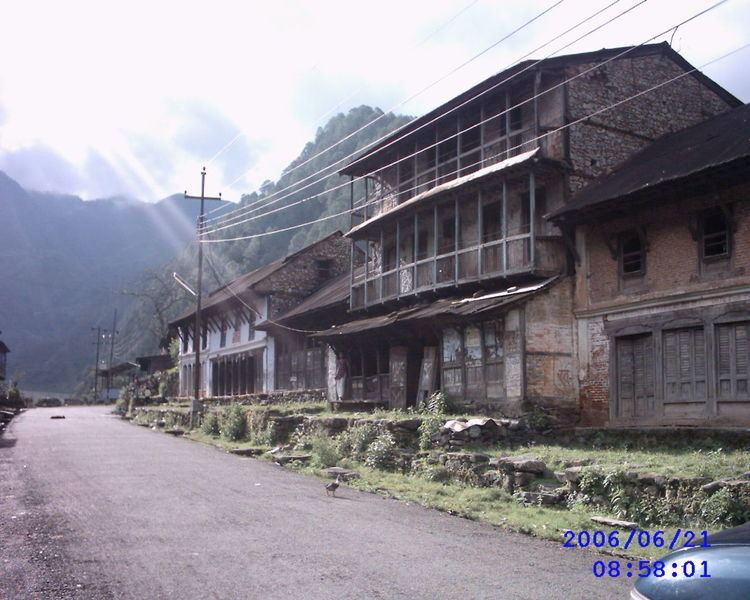
Bhimphedi (Nepali, Nepal Bhasa:भीमफेदी), is a village located in Makwanpur District of Narayani Zone of Nepal. This VDC is known for its bajar (marketplace).
Contents
Map of Bhimphedi 44100, Nepal
Etymology
The word "Bhimphedi" comes from Sanskrit word "Bhim" (a character from Mahabharat) and Nepali word "phedi" meaning a base of a hill. According to local beliefs, the Pandavas from Mahabharat had stayed in the forests of present day Bhimphedi during their time in exile. So, the place was called Bhimphedi.
History
Before the construction of highways, goods from India were taken to Kathmandu valley from this place. The first motor vehicles of Nepal were carried by people through this VDC. The VDC served as the district headquarters of Makwanpur before it was shifted to Hetauda. The market of the VDC suffered tremendously after the shifting of headquarters to Hetaunda.
Geography
Bhimphedi is located to the south of Kathmandu valley in Makwanpur district of Narayani zone, Nepal. The VDC is bounded by-
Demographics
According to 2001 census of Nepal, there were 1107 houses in Bhimphedi and 5742 (49% male, 51% female) people. The main population living in the market are Newars. There are Tamang and Khas population in villages.
Transportation
The main roads to Bhimphedi are-