
Area 492.6 km² | Time zone BRT (UTC-3) Local time Monday 2:45 AM | |
 | ||
Weather 19°C, Wind NE at 13 km/h, 93% Humidity | ||
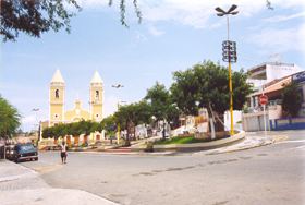
Bezerros (Calves) ([biˈzeʁus]) is a municipality in northeastern Brazil, in the State of Pernambuco, near the city of Gravatá. Its population was 60,386 (2015) and its area is 491 km². Also known as Papangu city, because a festive tradition in which the people dress masks of all types during the Carnival festivities. During the carnival time, it is one of the most visited cities in the interior of the state. Also, it was a center of coffee production, an activity which is no longer important in the region.is much visited during Carnival, tourists and locals love to see papangus parading in city streets.
Contents
- Map of Bezerros Encruzilhada Bezerros State of Pernambuco Brazil
- Geography
- Tourist attractions
- Economy
- Economic Indicators
- References
Map of Bezerros - Encruzilhada, Bezerros - State of Pernambuco, Brazil
Geography
Tourist attractions
Economy
The main activities based in Bezerros are tourism, commerce and agribusiness. Especially, plantations of tomatoes and creations of cattle'
Economic Indicators
Economy by Sector 2006