SFOS number 6205 Local time Monday 2:20 AM | Postal code 3991 & 3994 Elevation 1,970 m | |
 | ||
Weather -1°C, Wind W at 24 km/h, 74% Humidity Points of interest Bettmerhorn, Bettmersee, Mittelaletsch Glacier, Gletscherwelt Bettmerhorn, Chunschtspycher Bettmeralp | ||
Bettmeralp is a municipality in the district of Raron in the canton of Valais in Switzerland. On 1 January 2014 the former municipalities of Betten and Martisberg merged into the municipality of Bettmeralp. Before the merger, Bettmeralp was the name of a village and ski resort in Betten.
Contents
- Map of Bettmeralp Switzerland
- Bettmeralp village
- History
- Geography
- Demographics
- Historic population
- Sights
- Skilift system
- Panorama
- References
Map of Bettmeralp, Switzerland
Bettmeralp village
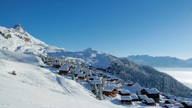
Bettmeralp is a car free village which can be reached by cable car from the Betten train station (Matterhorn Gotthard Bahn). From there another cable car leads near to the summit of Bettmerhorn, which lies directly above the Aletsch Glacier. Bettmersee is located above the village at 2006 m.
The position of Bettmeralp allows good view over the Pennine Alps, particularly the summits of Weissmies, Dom, Matterhorn and Weisshorn.
History
Betten is first mentioned in 1243 as Bettan. Martisberg is first mentioned in 1311 as Martisperg.
Geography
The former municipalities that now make up Bettmeralp have a total combined area of 29.36 km2 (11.34 sq mi).
Demographics
The total population of Bettmeralp (as of December 2015) is 452.
Historic population
The historical population is given in the following chart:
Sights
The entire hamlet of Eggen is designated as part of the Inventory of Swiss Heritage Sites
Skilift system
Bettmeralp village can only be reached via a cable car. The main ski lifts are:
Panorama
The village:
View from the village:
