
Area 74 km² | Local time Sunday 8:26 AM | |
 | ||
Administratively subordinated to Beryozovsky Town Under Oblast Jurisdiction Administrative center of Beryozovsky Town Under Oblast Jurisdiction Urban okrug Beryozovsky Urban Okrug Administrative center of Beryozovsky Urban Okrug Weather -7°C, Wind S at 16 km/h, 87% Humidity | ||
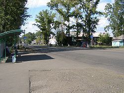
Beryozovsky (Russian: Берёзовский) is a town in Kemerovo Oblast, Russia, located between the Barzas and Shurap Rivers (Ob's basin), 27 kilometers (17 mi) north of Kemerovo, the administrative center of the oblast. Population: 47,279 (2010 Census); 48,299 (2002 Census); 51,250 (1989 Census).
Contents
- Map of Beryozovsky Kemerovskaya Oblast Russia
- History
- Administrative and municipal status
- Economy
- References
Map of Beryozovsky, Kemerovskaya Oblast, Russia
History
The settlement of Beryozovsky serving a mine construction was established in 1949 and named after the Beryozovskaya mine it was planned to serve. On January 11, 1965, the settlement was merged with nearby settlements of Kurganovka (Кургановка) and Oktyabrsky (Октя́брьский) to form the town of Beryozovsky.
Administrative and municipal status
Within the framework of administrative divisions, it is, together with two rural localities, incorporated as Beryozovsky Town Under Oblast Jurisdiction—an administrative unit with the status equal to that of the districts. As a municipal division, Beryozovsky Town Under Oblast Jurisdiction is incorporated as Beryozovsky Urban Okrug.
Economy
Coal mining and enrichment are the main activities.