
Elevation 220 m (720 ft) Time zone CET (UTC+1) Local time Sunday 1:36 AM | Demonym(s) Bertinoresi Postal code 47032 | |
 | ||
Frazioni Bracciano, Capocolle, Collinello, Fratta Terme, Ospedaletto, Panighina, Polenta, San Pietro in Guardiano, Santa Croce, Santa Maria Nuova Spallicci Weather 9°C, Wind SW at 5 km/h, 69% Humidity | ||
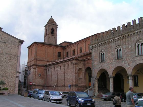
Bertinoro is a town and comune in the province of Forlì-Cesena, Emilia-Romagna (Italy). It is located on hill, Mount Cesubeo, in Romagna, a few kilometers from the Via Emilia.
Contents
- Map of 47032 Bertinoro Province of ForlC3AC Cesena Italy
- History
- Main sights
- Culture
- People
- Twin towns
- References
Map of 47032 Bertinoro, Province of Forl%C3%AC-Cesena, Italy
History
There are remains of a settlement dating from the Iron Age, next to the frazione of Casticciano. As for Bertinoro itself, it was probably a strongpoint on the Roman road connecting Forlì to Rimini. Later, during the barbaric invasions, it was moved to the current location.
In 1177 the castle, already well developed and known as Castrum Cesubeum, housed the emperor Frederick Barbarossa. The named changed to Castrum Brittinori during the reign of Otto III, becoming seat of countship.
Main sights
Culture
Bertinoro is home to a "Hospitality Festival". Held in the first weekend of September, it foresees an entire night of music, dances and events (between Friday and Saturday), some historic rievocations and the final Hospitality Rite (Sunday late morning).
In this ceremony anyone can be hosted for meal by a family in the town simply taking one of the envelopes tied to the rings of the Hospitality column (which inside has the name of the hosting family).