
3.6 Potsdamer Platz | ||
 | ||
2.0 FriedrichstraßeStadtbahn | ||
The North–South S-Bahn Tunnel (German: Nord-Süd-Tunnel) is the central section of the North–South transversal Berlin S-Bahn connection crossing the city centre. It is not to be confused with the Tunnel Nord–Süd Fernbahn, the central tunnel part of the North–South main line used by intercity and regional trains. The S-Bahn North–South line encompasses the route from Bornholmer Straße and Gesundbrunnen via Friedrichstraße and Anhalter Bahnhof to Priesterweg (today Südkreuz) and Schöneberg.
Contents
- Function
- History
- Building
- Flooding
- Restoration
- Division of Berlin
- Reunification
- Specification
- Stations
- Planning and Development S21
- References
The North–South S-Bahn Tunnel has a limited profile (loading gauge - G2) with a height of 3.83 metres (12 ft 7 in) above the trackhead and a width of 3.43 metres (11 ft 3 in).
Function
This tunnel originally provided an S-Bahn connection from the former mainline stations of Anhalter Bahnhof and Potsdamer Bahnhof with the interchange for the East-West Stadtbahn at Friedrichstraße and on to the Stettiner Bahnhof (today: Nordbahnhof). The tunnel connects three southerly suburban lines (the Wannsee Railway from Wannsee, the Anhalt Suburban Line from Teltow Stadt and the Dresden line from Blankenfelde) with three northerly suburban lines (the Kremmen Railway from Hennigsdorf, the Northern Railway from Oranienburg and the Stettiner Bahn from Bernau).
History
The idea of a north-south cross-town railway emerged not long after the completion of the east-west cross-town railway called the Stadtbahn ("City Railway") in 1882. The construction of an elevated line like the Stadtbahn was ruled out because of extensive building along the route, and a tunnel would have been highly problematic in the steam age.
By the end of the 19th century, Siemens proposed an underground line similar to the lines that later became what is today called the U-Bahn, connecting the Wannsee substation of the Potsdamer Bahnhof to the then Stettiner Bahnhof. In 1911, within the framework of a much broader competition for proposals for the further development of the city of Berlin, several proposals for such a north-south railway interconnection were set forth. The discussion was revived in the 1920s after the First World War. The advent of electrification made a tunnel solution possible.
The work was finally begun in 1933 as one of the public works undertaken by the new National Socialist government to put the unemployed to work (similar to Roosevelt's New Deal, but under opposite political conditions). The decision was taken in 1933, plans were made, and the first stones were moved in 1934.
Building
Because of the number of underground lines to be crossed, the need to pass under rivers and streams meant that tight curves, small-profile tunnels and steeper inclines than normal were incorporated into the planning parameters.
Building commenced in 1934 with the construction of the new stations Bornholmer Straße north of the S-Bahn Ring and Humboldthain inside the Ring between Berlin Gesundbrunnen and the then still existing Stettiner Bahnhof.
The tunnel section from north of the Stettiner Bahnhof to the new station Unter den Linden was opened on 28 May 1936, just in time for the 1936 Berlin Olympics, despite the collapse of a section of the tunnelling work near the Brandenburger Tor (adjacent to the US-American Embassy) on August 20, 1935, killing 19 workers.
This stretch was extended to the new underground Potsdamer Platz station in April 1939, and the connection to the Southern suburban lines via Anhalter Bahnhof was opened on 9 October 1939.
The construction of the Southern section was marred by a number planning changes. The original plan, as it stood in 1936, was to introduce the Ringbahn, which branched to the Potsdamer Bahnhof (actually the Potsdamer Ring- und Vorortbahn adjacent to the Potsdamer Bahnhof) into the underground Potsdamer Platz station separately from the three southern suburban lines, and into the two centre tracks, after driving the Ringbahn branch into the underground at about the same location of the then Potsdamer Ring- und Vorortbahnhof serving the Ringbahn branch and the two suburban lines on the Anhalter and Dresden railway lines. Those Ringbahn trains would reverse in a staging area north of the underground Potsdamer Platz station, which was designed as the upper level of the two-floor tunnel underneath the north-south street formerly and later called Ebertstraße but back then Hermann-Göring-Straße. This two-level design was chosen out of the scarcity of space, and in order to allow a later extension to the then Lehrter Bahnhof and its suburban lines to Nauen and Wustermark.
This stabling and reversal yard with its inherent possibility of extension north could be used as part of the S21 line to the new Berlin Hauptbahnhof, then on to the northern section of the Ringbahn.
The original plan also envisaged uniting the Wannseebahn and the Ringbahn branch by converting the Kolonnenstraße station serving the Ringbahn branch to an interchange station between the Ringbahn branch and the Wannseebahn, and the construction of a new station just south of the Landwehrkanal as a replacement for the Potsdamer Ring- and Vorortbahnhof which moved north into the Potsdamer Platz underground station.
Owing to the planning for the transformation of the Reichshauptstadt the plan for this curve was not realised. Instead, spurs for a junction to Anhalter Bahnhof were built with the plan for a further underground section to Görlitzer Bahnhof and, south of the Landwehr Canal, four tunnel spurs taking the North–South Line to the planned S-Bahn station Hornstraße.
But all further construction was halted by the war which Hitler began a few weeks before the Grand Opening of the complete North-South S-Bahn line.
Flooding
(see also History of the Berlin U-Bahn#World War II)
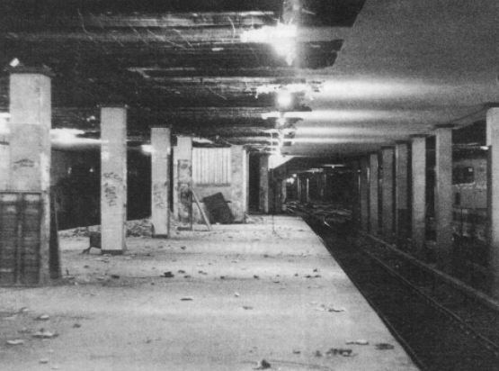
Shortly before the end of the Second World War on 2 May 1945, there was a detonation of explosives under the Landwehrkanal. As a result, the entire tunnel and (via a connecting tunnel at Friedrichstraße) part of the Berlin Underground network was flooded. There are few other examples in the history of Berlin that have produced so much conflicting information. It is debatable whether people were drowned during the flooding, because it is possible these drownings were confused with the 80 to 130 bodies of victims of the last days of the war, who died before the tunnel was flooded. Also debatable (and to this day also unclear) is who actually demolished the tunnel and who had ordered it. In order to cause such an explosion, a very good knowledge of the area and buildings would be required. One theory states that the explosion was undertaken by members of the SS. There are few eyewitnesses who can actually verify this. Rather they report that in the last days of the war the tunnel was already partially flooded with fresh and sewage water that was leaking from damaged pipes.
Restoration
Although the repairs were begun immediately after 1945, the tunnel could not be used again until 1947. The S-Bahn lines of the southerly suburban lines first had to be taken back to the overground Potsdamer Bahnhof before, in 1946, it was possible to use the underground line to Anhalter Bahnhof again.
Division of Berlin
With the building of the Berlin Wall in 1961 all the stations in East Berlin were shut, except for Friedrichstraße which was used as a border crossing point. Trains that were now only for use in West Berlin travelled between Anhalter Bahnhof via Friedrichstraße to Humboldthain without stopping. On the evening of 8 January 1984, operation of the section was handed over to the Berliner Verkehrsbetriebe (BVG). The restoration of traffic through the tunnel restarted in May of that year. No works were allowed to be carried out on the Nord-Süd Tunnel during the division of Berlin.
Reunification
The Berlin Nord-Süd Tunnel had been heavily renovated three times, twice during the time of East German rule, and with the installation of a new signalling system in the later phase. When the Berlin Wall was opened and destroyed in 1990, discussions were ongoing to reopen all the Berlin Nord-Süd Tunnel stations in March 1990 together with the U6 and U8. However, Oranienburger Straße, Nordbahnhof and Unter den Linden stations began the modernisation programme to remove armed guards and out-of-bounds signage, and to do thorough cleanup work, with Oranienburger Straße reopening on 2 July 1990, while Nordbahnhof, together with Unter den Linden reopened on 1 September 1990.
Bornholmer Straße, a station that straddled the former "sector boundary" (between East and West Berlin), reopened on 22 December 1990, and there were no checkpoint and armed guards before then. The eastern part was opened fully in March 1991.
The first comprehensive renovation since 1945 started from January 1991 in subsections, but was converted in mid-1991 to a complete closure due to the high levels of dust. The Deutsche Reichsbahn replaced almost all the material in the tunnel walls, then cleaned and recoated them. Hence the wartime flood damage to the tunnel was finally removed. This was finally achieved on 1 March 1992 when Potsdamer Platz was reopened. The border controls were abolished on 23 July 1990. During the refurbishment of Potsdamer Platz, opaque glass panels were installed, but other errors have been committed: the station labels differ from the Tannenberg Fraktur of the originals, and the letters of the platform-side walls are convex rather than sunk into the shallow etched-glass panels. The original pattern can be seen at the Berlin S-Bahn Museum.
Another renovation began in February 2002 and ended in October 2002, which removed all the last traces of East Berlin.
The building of the new heavy-rail tunnel to the Hauptbahnhof and the connected electromagnetic effects of the overhead wiring meant that a new compatible signalling system had to be installed. This work was undertaken between July 2005 and May 2006. The North–South Line was the last section of the Berlin S-Bahn network to have the automatic Block signalling of type AB 37 and Sv-Signals with aperture relay installed.
Specification
In order for the tunnel to follow the roadway in the heavily built-up city centre, the tightest curve in the North–South Tunnel is only 150 m. To operate the trains safely, this required a special profile to be developed for the wheels. The BVG encountered several derailments of its stock, which had only a standard wheel profile. The permissible height in the tunnel is also restricted. Therefore, trains of type DRG BR ET 169, which have a greater height and longer body, can also not be used in the tunnel. The restrictions in carriage height and length continue to limit the trains that can be used. In particular, trains constructed for other cities cannot be used for the DC S-Bahn system of Berlin.
Stations
South of the Anhalter Bahnhof the tunnel divides in two directions for the Wannsee line (line S1) and the Anhalt line/Dresden line (lines S2 and S25). These two tunnels then surface:
The present subsequent stations of (Yorckstraße and Yorckstraße (Großgörschenstraße)) exist as two separate stations, a couple of hundred metres apart, with separate entrances, although they are today collectively known as Yorckstraße with the Yorckstraße U-Bahn station (U7) running east-west between them.
The architect of most of the stations in the North–South tunnel is Richard Brademann, specifically: Bornholmer Straße, Humboldthain, Oranienburger Straße (Brademann's first S-Bahn Underground station), Unter den Linden, Potsdamer Platz and Anhalter Bahnhof. Stettiner S-Bahnhof had Lüttich as its architect; Friedrichstraße had von Hane. Although they were built in the middle of the National Socialist period, the stations have none of the architecture of National Socialism, rather the officially taboo New Objectivity of the earlier Modern style. Except in a few details, e.g. the mosaic of the emblem in the northern distribution area of S-Bahnhof Potsdamer Platz, with its exit to the New Reich Chancellery, the stations do not follow typical National Socialist Architecture.
The stations were rehabilitated after the fall of the communist government (the Wende) in the light of conservation issues, but important details were not faithfully restored, e.g. the typical station S-Bahn sign outside the station, designed by Richard Brademann, never matched the original. Closest to the original S-Bahn sign are the ones at Anhalter Bahnhof (although instead of the cast iron cutout in the shape of the S-Bahn "S", today they only have a backlit glass screen). During the renovation of Anhalter Bahnhof, the BVG (on behalf of the Senate Construction Administration) attempted to restore the original look of the station and placed enamelled tin plates on the walls. However, in contrast to the original white opaque glass panels, the new ones have completely different light reflections, and instead of white, inconspicuous seams between the panels, the seams reveal a black grid. At Potsdamer Platz they have installed opaque glass panels but have committed other errors: the station labels differ from the Tannenberg Fraktur of the originals, and the letters of the platform-side walls are convex rather than stuck in the shallow etched glass panels. The original pattern can be seen at the Berlin S-Bahn-Museum. There are also labels in the Helvetica font which was until recently used by Deutsche Bahn. During construction of the Regional station, the western part of the distribution hall between the surface and platforms has been cut off. More modern fixtures have also destroyed the original spatial effect.
Since 8 August 2009, in connection with the opening of the interchange with the new U55 line, Unter den Linden has been renamed Brandenburger Tor, although the original name tiles remain on the station walls.
Planning and Development (S21)
In the medium term the tunnel will be further developed with a second north–south section connecting to Hauptbahnhof. This project is being pursued under the planning name of S21 and should improve the currently poor connection of the new Berlin Hauptbahnhof with the North–South S-Bahn line.
This project will proceed in the following stages:
The additional usage of this section is limited as there is already a connection at Potsdamer Platz to the U2 Line and at Gleisdreieck only the U1 would be provided with an additional connection.
The building work for the northerly section up to the Hauptbahnhof, which will be funded by the German Federal Government via the Community Transport Financing law, will cost 24 million Euro and be completed between 2011 and 2013. The remaining section should, as envisaged by the financial planning for the Land of Berlin, be built by 2030.
In July 2007 the German Railway announced delays in the construction of the first stage. After they had concluded the financial agreement and thereby delayed the under-signing of the project, the building work would start in 2008, rather than at the end of 2007 as planned.
Some preparatory work has already been completed, including the diversions at the Ringbahn stations of Westhafen and Wedding, the preservation of the route during the building of the Hauptbahnhof and the Tiergartentunnel, along which the new line will run. To the south of the Hauptbahnhof the line will continue easterly of the Reichstag building and then crossing the U55 to the west of Brandenburger Tor where it will join the old North–South Tunnel. South of Potsdamer Platz the new line will divert from the old North–South Tunnel and run parallel to the U2 to Gleisdreieck before connect to the existing S-Bahn line at Yorckstraße (Großgörschenstraße). Connections at the north and south ends of Potsdamer Platz station already exist.