
Time zone CET/CEST (UTC+1/+2) Area 19.56 km² Population 1,694 (30 Jun 2009) Dialling code 05657 | Postal codes 37297 Local time Saturday 7:09 PM Postal code 37297 Administrative region Kassel | |
 | ||
Weather 11°C, Wind E at 10 km/h, 70% Humidity | ||
Berkatal is a community in the Werra-Meißner-Kreis in Hesse, Germany.
Contents
- Map of Berkatal Germany
- Location
- Neighbouring communities
- Constituent communities
- Frankershausen
- Frankenhain
- Hitzerode
- Amalgamation
- Community council
- Mayors
- Community executive
- Coat of arms
- Culture and sightseeing
- References
Map of Berkatal, Germany
Location
Berkatal lies in the Meißner-Kaufunger Wald Nature Park at the foot of the Hoher Meißner massif. The river Berka rises within community limits.
Neighbouring communities
Berkatal borders in the west and north on the town of Bad Sooden-Allendorf, in the east on the town of Eschwege, in the south on the community of Meißner and in the southwest on the towns of Hessisch Lichtenau and Großalmerode (all in the Werra-Meißner-Kreis).
Constituent communities
Berkatal’s three Ortsteile are Frankenhain, Frankershausen (administrative seat) and Hitzerode. The nearest major town is the district seat of Eschwege. Berkatal lies roughly 40 km south of Göttingen and 45 km east of Kassel.
Frankershausen
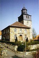
The constituent community of Frankershausen, having had its first documentary mention in 876, is one of the region’s oldest settlements. At first, Frankershausen was within the lands held by the Counts of Bilstein, who sold the village in 1301 to the Landgraves of Hesse. The Landgraves enfeoffed various noble families with the rights to Frankershausen over the course of its history. Originally, the village core stretched around the village church, which was expanded in the Classicist style. With the beginning of the salt trade in the 16th century, the valley was settled alongside the Berka. In time arose great estates with stately houses with cellars in which was kept wine from the Rhineland meant for sale. Still bearing witness today to the Frankershausen salt and wine dealers’ wealth are the preserved houses from the late 18th century along the Berkastraße and Am Wasser (“At the Water”). In business in Frankershausen today are many craft businesses and trade operations, along with a small metal-processing business. In 1976, the community’s 1,200-year jubilee was celebrated.
Frankenhain
The constituent community of Frankenhain, having had its first documentary mention in 1360, is the community’s third oldest place. The community acquired economic ascendancy during the boom in the salt and wine trades, to which the dwellers of the whole Meißnervorland dedicated themselves beginning in the 16th century. The resident wagon drivers built along what is today the Meißnerstraße extensive estates with the typical great cellars for keeping wine. In the 19th century, mining and melting pot making became the main sources of livelihood for Frankenhain’s inhabitants. Even today, there is still a business in Frankenhain that produces melting pots, which sells its products worldwide.
Hitzerode
The constituent community of Hitzerode had its first documentary mention in 1195 in a document from Pope Celestine III, in which he confirmed the Germerode Monastery’s lordship. About 1300, Hitzerode passed to the Landgraves of Hesse. In 1498, one half belonged to the Landgraviate of Hesse and the other half was enfeoffed to the Lords of Völkershausen, and later to the Apel Appe zu Aue and the Lords of Eschwege. The village’s history was shaped, as in the community’s other centres by the salt and wine trade. Early in the village’s history, building was confined to the Kirchberg (“Church Hill”) and the course of the Albunger Straße (road). So, when the salt trade was beginning, the Lange Straße (“Long Road”), was also built up. This ran from Dohlsbach towards Frankershausen, across the Meißner to Spangenberg. Here arose the merchants’ representative estates which still characterize the settlement today. In 1995, the settlement’s 800-year jubilee was marked.
Amalgamation
In 1971, by merging the centres of Frankenhain and Frankershausen, the community was founded. One year later, Hitzerode was also amalgamated. As it was unclear until then whether Hitzerode would be amalgamated with Bad Sooden-Allendorf, it still has the telephone area code 05652 (Bad Sooden-Allendorf) today, whereas the other two centres both have the area code 05657 (Meißner).
Community council
The municipal election held on 26 March 2006 yielded the following results:
Mayors
Since 1997 the community’s mayor has been Friedel Lenze (SPD). His predecessors were Willi Hildebrandt (SPD) from 1971 to 1979, Ferdinand Nieland (CDU) from 1979 to 1991 and Hansjörg Haas (CDU) from 1991 to 1996.
Community executive
As laid down in Hessian law, the community of Berkatal has an executive (Gemeindevorstand) as the community’s collective leadership board. On this board, besides Mayor Friedel Lenze are two members each of the CDU, the SPD and the ÜWG. The ranking member, and thereby the deputy mayor, is Lutz Bergner (CDU). The executive’s chairman is Manfred Zindel (ÜWG).
The executive has two committees, each with five members: a main, financial and social committee and a building and planning committee. The former’s chairman is Bernd Fink (ÜWG) and the latter’s Wolfgang Friederich (CDU).
The three parties or voter communities represented on the executive have each joined together into a faction, with Matthias Dix as the CDU faction’s chairman, Reinhard Philipp as the SPD faction’s and Thomas Schill as the ÜWG faction’s.
Coat of arms
The community’s arms might be described thus: Gules a bend sinister wavy argent between a cross moline and a wagon wheel of six spokes Or.
The wavy bend sinister represents the community’s namesake, the Berka. The cross is the Frankenkreuz, a reference to the names Frankershausen and Frankenhain. The wagon wheel stands for the wagon drivers who were once widespread here.