
Country United States FIPS code 31-04160 Elevation 456 m Zip code 68315 Local time Thursday 12:55 PM | Time zone Central (CST) (UTC-6) GNIS feature ID 0827316 Area 124 ha Population 48 (2013) Area code 402 | |
 | ||
Weather 9°C, Wind N at 27 km/h, 34% Humidity | ||
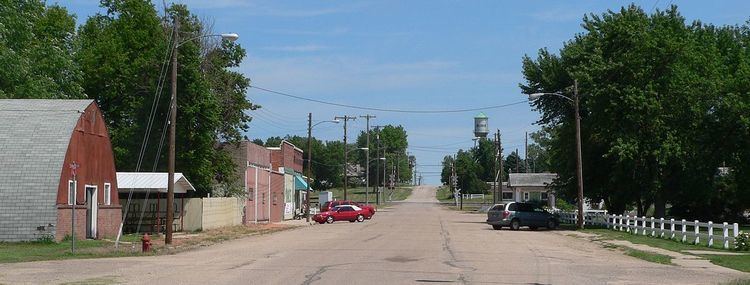
Belvidere is a village in Thayer County, Nebraska, United States. The population was 48 at the 2010 census.
Contents
Map of Belvidere, NE 68315, USA
History
Belvidere had its start in the year 1872 by the building of the railroad through that territory. Belvidere is derived from an Italian name meaning "beautiful to see".
Geography
Belvidere is located at 40°15′12″N 97°33′26″W (40.253419, -97.557153).
According to the United States Census Bureau, the village has a total area of 0.48 square miles (1.24 km2), all of it land.
2010 census
As of the census of 2010, there were 48 people, 24 households, and 10 families residing in the village. The population density was 100.0 inhabitants per square mile (38.6/km2). There were 32 housing units at an average density of 66.7 per square mile (25.8/km2). The racial makeup of the village was 95.8% White and 4.2% from two or more races. Hispanic or Latino of any race were 2.1% of the population.
There were 24 households of which 16.7% had children under the age of 18 living with them, 33.3% were married couples living together, 4.2% had a female householder with no husband present, 4.2% had a male householder with no wife present, and 58.3% were non-families. 54.2% of all households were made up of individuals and 20.8% had someone living alone who was 65 years of age or older. The average household size was 2.00 and the average family size was 2.80.
The median age in the village was 47.5 years. 22.9% of residents were under the age of 18; 8.4% were between the ages of 18 and 24; 18.8% were from 25 to 44; 33.4% were from 45 to 64; and 16.7% were 65 years of age or older. The gender makeup of the village was 54.2% male and 45.8% female.
2000 census
As of the census of 2000, there were 98 people, 40 households, and 21 families residing in the village. The population density was 204.1 people per square mile (78.8/km²). There were 43 housing units at an average density of 89.6 per square mile (34.6/km²). The racial makeup of the village was 100.00% White.
There were 40 households out of which 30.0% had children under the age of 18 living with them, 45.0% were married couples living together, 7.5% had a female householder with no husband present, and 47.5% were non-families. 42.5% of all households were made up of individuals and 17.5% had someone living alone who was 65 years of age or older. The average household size was 2.45 and the average family size was 3.62.
In the village, the population was spread out with 30.6% under the age of 18, 6.1% from 18 to 24, 22.4% from 25 to 44, 29.6% from 45 to 64, and 11.2% who were 65 years of age or older. The median age was 40 years. For every 100 females there were 75.0 males. For every 100 females age 18 and over, there were 78.9 males.
As of 2000 the median income for a household in the village was $26,250, and the median income for a family was $48,750. Males had a median income of $19,583 versus $17,500 for females. The per capita income for the village was $20,278. There were no families and 7.2% of the population living below the poverty line, including no under eighteens and 18.2% of those over 64.