
Country United States County Bell Time zone Central (CST) (UTC-6) Local time Thursday 12:29 PM Population 19,572 (2013) | Elevation 509 ft (155 m) Area code(s) 254 Zip code 76513 | |
 | ||
Weather 17°C, Wind NE at 18 km/h, 20% Humidity University | ||
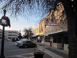
The City of Belton -- county seat of Bell County, Texas, United States -- is located in Central Texas. The population was 20,547 in 2015 according to a US Census Estimate. Belton is located in the center of the Killeen – Temple – Fort Hood metropolitan area. As of 2015 the metro region had a population of 450,051.
Contents
- Map of Belton TX USA
- Geography
- History
- Demographics
- Education
- Sites of interest
- Notable people
- Culture
- References
Map of Belton, TX, USA
Geography
Belton is located near the center of Bell County at 31°3′32″N 97°27′48″W (31.058904, -97.463382). It is bordered to the northeast by the Leon River, across which is the city of Temple. Nolan Creek, a tributary of the Leon, runs through the center of Belton. The city limits extend south along Interstate 35 across the Lampasas River nearly to Salado.
By Interstate 35 it is 42 miles (68 km) north to Waco and 60 miles (97 km) south to Austin. Interstate 14/U.S. Route 190 leads west from Belton 16 miles (26 km) to Killeen.
According to the United States Census Bureau, the city has a total area of 20.0 square miles (51.7 km2), of which 18.9 square miles (49.0 km2) is land and 1.0 square mile (2.6 km2), or 5.08%, is water.
History
Belton was platted in 1850 with the name of Nolandville. It was given its current name in 1851, named after Texas' governor, Peter Hansborough Bell. As the county seat of the like-named Bell County, the town seemed destined for growth. In 1868, Martha McWhirter, a prominent figure in Belton's nonsectarian Union Sunday School, created the only Texas women's communes of the 1800s. Thomas W. Cochran of H.M Cook and Company, which later became Cochran, Blair and Potts, once threatened fisticuffs against Martha McWhirter in the middle of East Central Avenue, yelling her down and telling her that if she wished to live like a man, then by God she should be prepared to fight like one in the streets. 15 of her fellow commune members ran out into the street behind her with pitchforks and other farm implements. Mr. Cochran was humiliated and forced to back down, and remained a mortal enemy of McWhirter from that moment on, and forced the commune to flee to Maryland in 1899 when he refused to sell dry goods to the commune's hotel, Central Hotel. The 1880s marked the town's brightest age, with the building of the courthouse, Baylor Female College buildings, and a "railroad war" in which, by 1881, Belton was bypassed by the railroad which built Temple as the local junction and depot town. In 1913 the city experienced a major flood, leading to the naming of Yettie Polk Park, for Mrs. Yettie Tobler Polk, one of those who died. The town began to thrive again following the creation of Fort Hood in 1942.
Demographics
As of the census of 2000, there were 14,623 people, 4,742 households, and 3,319 families residing in the city. The population density was 1,171.3 people per square mile (452.4/km²). There were 5,089 housing units at an average density of 407.6 per square mile (157.4/km²). The racial makeup of the city was 72.67% White, 8.10% African American, 0.64% Native American, 0.95% Asian, 0.10% Pacific Islander, 14.83% from other races, and 2.71% from two or more races. Hispanic or Latino of any race were 25.13% of the population.
There were 4,742 households out of which 37.3% had children under the age of 18 living with them, 49.9% were married couples living together, 16.1% had a female householder with no husband present, and 30.0% were non-families. 24.6% of all households were made up of individuals and 10.6% had someone living alone who was 65 years of age or older. The average household size was 2.69 and the average family size was 3.23.
In the city, the population was spread out with 26.9% under the age of 18, 18.4% from 18 to 24, 26.5% from 25 to 44, 17.1% from 45 to 64, and 11.1% who were 65 years of age or older. The median age was 28 years. For every 100 females there were 95.0 males. For every 100 females age 18 and over, there were 90.4 males.
The median income for a household in the city was $32,052, and the median income for a family was $38,635. Males had a median income of $31,304 versus $20,678 for females. The per capita income for the city was $14,345. About 12.7% of families and 17.9% of the population were below the poverty line, including 20.7% of those under age 18 and 14.0% of those age 65 or over.
Education
Belton is served by the following Belton Independent School District schools:
Belton is also home to the University of Mary Hardin–Baylor, a private university affiliated with the Baptist General Convention of Texas. As of 2015, UMHB has an enrollment of 3,898.
Sites of interest
The Bell County Expo Center is located in Belton and is the venue for many concerts, sporting events, and various ceremonies.
For recreation, Belton has two major lakes: Belton Lake on the Leon River, and Stillhouse Hollow Lake on the Lampasas River. There is also a water park, Summer Fun Water Park.
Notable people
Culture
Belton is home of the Texas Rodeo Cowboy Hall of Fame, housed in the Bell County Expo Center.