
OS grid reference SD717246 Local time Thursday 6:25 PM Dialling code 01254 | Unitary authority Sovereign state United Kingdom | |
 | ||
Weather 4°C, Wind SW at 13 km/h, 73% Humidity | ||
Belthorn is a small moorland village situated to the south-east of Blackburn in Lancashire, England. It is about half a kilometre away from junction 5 of the M65 motorway, which runs from Colne to Preston. Belthorn has a primary school, Belthorn Academy, and a large playing field with a children's recreational area with swings etc.
Contents
Map of Belthorn, Blackburn, UK
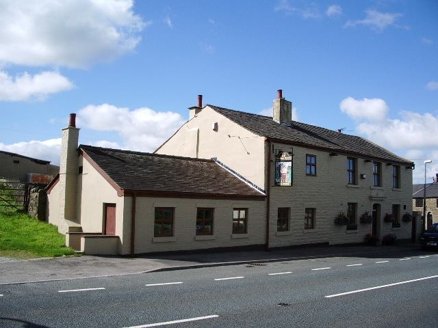
The village has two pubs: the community owned, recently reopened Dog Inn and the Pack Horse; the Pack Horse is an Italian restaurant and the Dog Inn serves pub food. The houses are mainly old weavers' cottages. Most of the village is in Hyndburn, though some of the houses, including those higher up in the village, are in Blackburn with Darwen.
Governance
The village is divided between the unitary authority of Blackburn with Darwen and the district of Hyndburn, both of which have borough status. The portion of the village within Blackburn with Darwen is largely within the ancient parish (now a civil parish) of Yate and Pickup Bank, with a small area in the north of the village, formerly in the parish of Lower Darwen.
The part of the village in Hyndburn was formerly part of the township of Oswaldtwistle.
Belthorn has its own community website, [1] which includes community news and details of upcoming events.