
Type Geological supergroup Underlies Flathead Formation | Sub-units Many | |
 | ||
Thickness up to 30 kilometres (19 mi) | ||
Idaho belt supergroup presentation
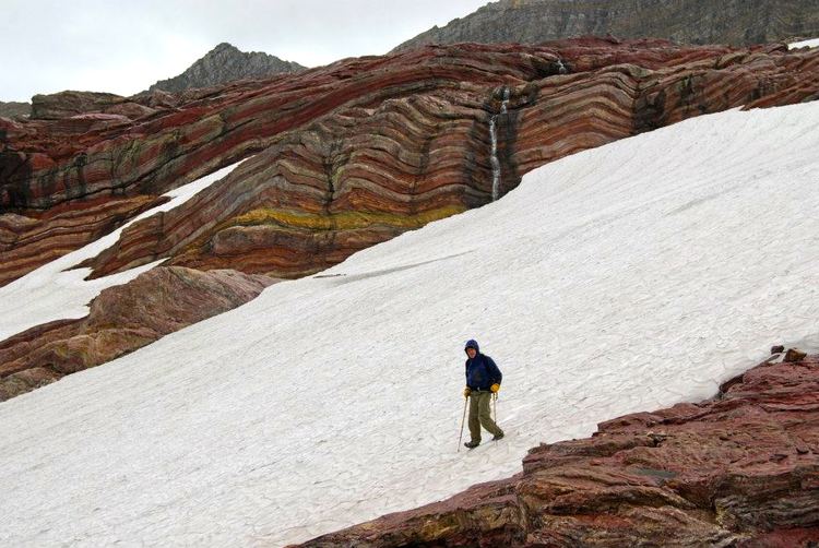
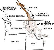
The Belt Supergroup is an assemblage of primarily fine-grained sedimentary rocks and mafic intrusive rocks of late Precambrian (Mesoproterozoic) age. It was named after the Big Belt Mountains in west-central Montana. It is present in western Montana and northern Idaho, with minor occurrences in northwestern Washington and western Wyoming. It extends into Canada where the equivalent rocks are called the Purcell Supergroup and are exposed in southeastern British Columbia and southwestern Alberta. Spectacular outcrops of these rocks can be seen in Glacier National Park in northwestern Montana and in Waterton Lakes National Park in southwestern Alberta.
Contents
- Idaho belt supergroup presentation
- The belt supergroup
- Lithology and sedimentology
- Paleogeography and environment of deposition
- Stratigraphy and distribution
- References
The belt supergroup
Lithology and sedimentology
The Belt Supergroup is dominated by fine-grained sedimentary rocks, primarily mudstones, siltstones, fine-grained quartzose sandstones and limestones. Most have undergone weak metamorphism to greenschist facies, and as a result the mudrocks are commonly classified as argillite and the sandstones as quartzites. The Belt Supergroup also includes lesser amounts of coarser grained sandstones and conglomerates. Mafic intrusive rocks are present locally in the lower portion.
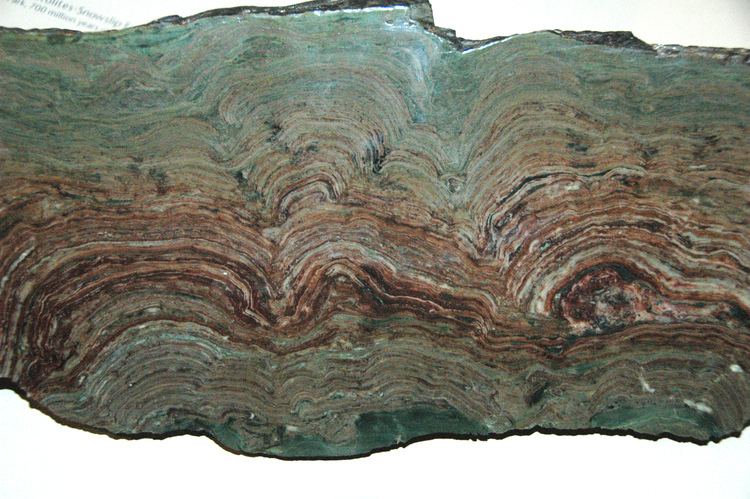
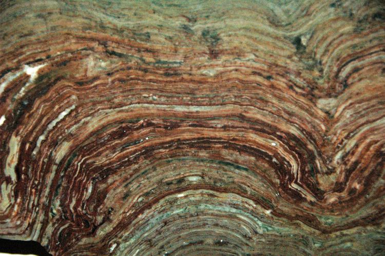
Sedimentation occurred between 1470 and 1400 Ma (million years) ago. Sedimentary structures are well preserved in most of the Belt rocks despite their great age. The sedimentation is unusual in that 1) there is an abundance of fine-grained sediment and very little coarser sediment, 2) there is a lack of sequence boundaries that are common in Phanerozoic sediments, and 3) cyclic and rhythmic deposition occurred over long periods of time. The Belt Supergroup is also noted for "Molar Tooth" structures in carbonates (a bacterial degassing structure) and abundant stromatolites of various types.
Paleogeography and environment of deposition
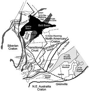
Paleogeographic reconstructions indicate that the Belt Supergroup accumulated in a fault-bounded rift basin that existed where the North American craton and another landmass were joined in a supercontinent called Columbia/Nuna. The basin appears to have been a closed "lacustrine" environment, or at least not completely open marine. Depositional environments are thought to have ranged from ancient floodplains and exposed mudflats to deep water.
Evidence of the basin-bounding faults exists on all sides of the Belt basin except the west, which rifted away during subsequent contintntal breakup. The identity of the joined landmass remains controversial. The Siberian craton, Australia and eastern Antarctica have all been suggested based rock ages and paleomagnetic information.
Stratigraphy and distribution
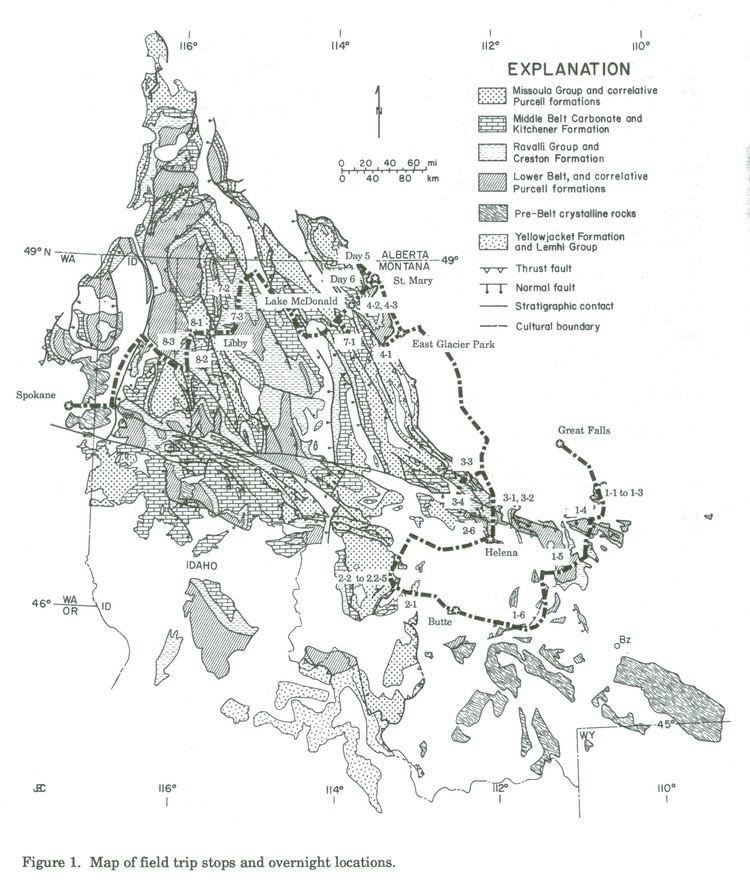
The Belt Supergroup reaches thicknesses of up to 30 km and is present in western Montana and northern Idaho, with minor occurrences in northwestern Washington and western Wyoming. Because of this widespread extent, the rock types and formation names of the Belt Supergroup vary depending upon location. In western Montana and northern Idaho the Belt is divided into the following four groups (youngest to oldest):
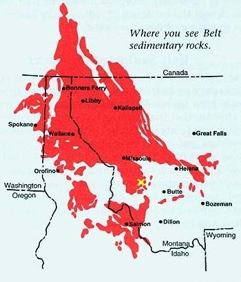
The Belt Supergroup extends into Canada where the equivalent rocks are called the Purcell Supergroup, and are exposed in southeastern British Columbia and southwestern Alberta.