
Type Road Length 89 km | Route number(s) B59Entire route | |
 | ||
Via Bell, Mount Tomah, Berambing, Bilpin, Kurrajong Heights, New South Wales, Kurmond, New South Wales, Richmond | ||
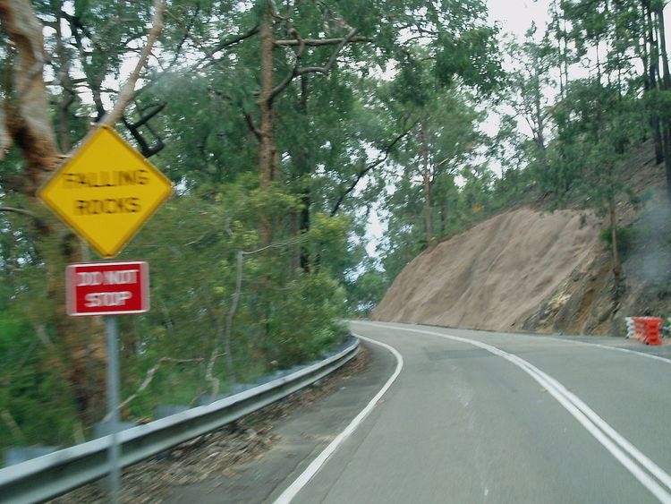
Dangerous condition of bells line of road bilpin
The Bells Line of Road is a 59-kilometre (37 mi) major road located in New South Wales, Australia, providing an alternative crossing of the Blue Mountains. The eastern terminus of the road is in Richmond on the northwestern outskirts of Sydney where the road continues as the Kurrajong Road and joins the A9. The western terminus of the road is in Bell in the Blue Mountains where the road continues as the Chifley Road.
Contents
- Dangerous condition of bells line of road bilpin
- Map of Bells Line of Rd New South Wales Australia
- Route
- Route numbering
- Lowered speed limits
- Future
- Alternate routes
- References
Map of Bells Line of Rd, New South Wales, Australia
The entire length of the Bells Line of Road is designated route B59.
The route, part of the traditional Aboriginal pathway network, was shown to Archibald Bell, Jr. by Darug men Emery and Cogy in 1823. They were accompanied by assistant government surveyor Robert Hoddle and the route they marked was known as Bell's Line, to be later cleared to become the second road across the Mountains. It was rarely used before World War II. The road was improved between 1939 and 1949 as it was seen by the government as being an alternative to the Great Western Highway and could be used for war efforts.
Today, the route is still used as an alternate route across the Blue Mountains and is also a popular tourist drive.
Route
The eastern terminus of the Bells Line of Road is east of Richmond Bridge, Richmond at the junction of Kurrajong Road and Old Kurrajong Road. At the Richmond Bridge the road crosses the Hawkesbury River and proceeds west through the towns of North Richmond and the village of Kurmond, before bypassing Kurrajong. It then proceeds to climb onto the Bell Range of the Blue Mountains, passing through Kurrajong Heights. When on the range it proceeds the fruit growing areas of Bilpin and Berambing, before climbing and descending Mount Tomah, passing by the Mount Tomah Botanic Gardens. After Mount Tomah it proceeds through the Blue Mountains National Park passing Mount Bell and Mount Charles as well as picnic areas such as Pierces Pass and Mount Banks. Eight kilometres (5.0 mi) before Bell is the turn off to the villages of Mount Wilson and Mount Irvine. The western terminus of the road is at Bell where the Bells Line of Road forms a junction with the Darling Causeway and the Chifley Road, with the latter continuing west to Lithgow.
The route has numerous sections of road that are steep and winding. The prime example of this is Bellbird Hill when the road rises around 450 metres (1,480 ft) from the Hawkesbury Valley to the Bell Range. The road is steep with a grade of 1:8 and has several tight bends. Other steep sections include the east and west ascents of Mount Tomah and Mount Bell as well as "The Glen" on the west side of Kurrajong Heights.
There is some confusion on the western terminus of the road. Historically, the Darling Causeway continued as the Bells Line of Road, terminating at Mount Victoria; with some claims and supporting road signage indicating that the road's western terminus is at Bowenfels near Lithgow.
Route numbering
The Bells Line of Road was formerly the larger part of State Route 40, which began in the Sydney CBD before journeying to Richmond, where it took the Bells Line of Road through to Lithgow. This continuous alternative signed route between Sydney and Lithgow was broken with the introduction of alpha-numerics in 2013; east of Windsor the State Route 40 became A2 then A40, and west of Windsor (including the Bells Line of Road) the B59.
Lowered speed limits
In November 2007, the Roads and Traffic Authority (RTA) announced plans to lower the speed limits along much of Bells Line of Road. Within a week, sufficient opposition was expressed that the changes were put on hold. In October 2008, the same changes were again announced, with the RTA claiming that there had been community consultation, but numerous users of the road, including politicians and councillors based west of the Blue Mountains, claimed to have been unaware of any consultation. As a result of the changes, the maximum speed limit east of Bell is now 80 kilometres per hour (50 mph).
Future
For many years road lobby groups have been pushing for what they call a "superhighway" across the Blue Mountains. They claim that the poor roads leading to the Central West of New South Wales are impeding growth. For many years the Great Western Highway was the preferred route, but after studies found that a freeway would be too expensive to build along this route the idea was abandoned.
In 2002, road lobby groups secured $2 million in funding for a feasibility study into building a freeway following the Bells Line of Road. The proposed freeway would have linked to the M2 Hills Motorway in Sydney and dropped into the Central West via Newnes Plateau. The study report, published in November 2004 concluded that, while feasible to build from an engineering perspective, it would not be economically feasible and would have massive impact on adjacent national parks and local communities.
Alternate routes
The next trafficable road north of Bells Line of Road that crosses the Blue Mountains is the Bylong Valley Way, which forms a more direct route between the Central West region and the Hunter Region including the port of Newcastle.