
Country United States County Boone FIPS code 21-05428 Elevation 155 m Population 343 (2010) | Time zone Eastern (EST) (UTC-5) GNIS feature ID 0486809 Local time Thursday 9:34 AM Area code 859 | |
 | ||
Weather 3°C, Wind W at 19 km/h, 62% Humidity Area 4.921 km² (3.626 km² Land / 129 ha Water) | ||
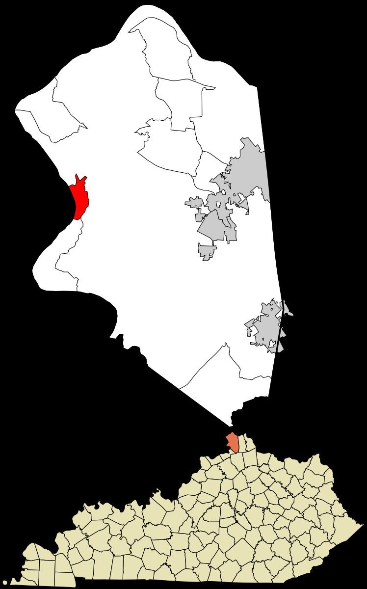
Belleview is an unincorporated community and census-designated place (CDP) in Boone County, Kentucky, United States. The population was 343 at the 2010 census.
Contents
Map of Belleview, KY 41005, USA
Geography
Belleview is located in western Boone County along the Ohio River, 24 miles (39 km) southwest of downtown Cincinnati. Kentucky Route 18 (Burlington Pike) runs east from Belleview 7 miles (11 km) to Burlington (the Boone County seat) and 13 miles (21 km) to Florence.
According to the United States Census Bureau, Belleview has a total area of 1.9 square miles (4.8 km2), of which 1.4 square miles (3.5 km2) is land and 0.50 square miles (1.3 km2), or 26.99%, is water, consisting of the Ohio River out to its centerline, which is the border with Indiana.
Belleview is the location of six places listed on the U.S. National Register of Historic Places: