
Founded 1981 | Name meaning House of Aryeh - Fawns | |
 | ||
Weather 12°C, Wind S at 10 km/h, 99% Humidity | ||
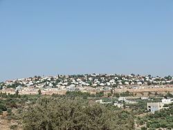
Beit Aryeh-Ofarim (Hebrew: בֵּית אַרְיֵה-עֳפָרִים) is an Israeli settlement and local council in the northern West Bank. It is located 32 kilometers (20 mi) north of Jerusalem and 25 kilometers (16 mi) east of Tel Aviv near the Palestinian village al-Lubban al-Gharbi, 3.8 km kilometers east of the Green line. It is situated inside the Israeli West Bank barrier on 8,500 dunams of land. In 2015 it had a population of 4,721.
Contents
Map of Beit Arye
The international community considers Israeli settlements in the West Bank illegal under international law, but the Israeli government disputes this.
History
Established in 1981, Beit Aryeh was recognised as a local council in 1989. In 2004, it merged with Ofarim. Beit Aryeh was named for Aryeh Ben-Eliezer, a Lithuanian-born Revisionist Zionist leader who served as a Knesset member in the 1950s and 1960s.
In 2011, the Israeli Ministry of Defense signed an agreement with the municipality of Beit Aryeh approving the construction of 100 homes and a bypass road between Beit Aryeh and Ofarim.