
Country United States Highest elevation N/A ft (N/A m) Area 6,185 km² | State(s) Texas Lowest elevation 0 ft (0 m) | |
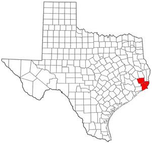 | ||
The Beaumont–Port Arthur metropolitan area is defined by the United States Census Bureau as a four-county region in Southeast Texas. The metropolitan area shares borders with the Houston–The Woodlands–Sugar Land metropolitan area to the west and the Lake Charles metropolitan area to the east. The area is also known as the Golden Triangle. The "golden" refers to the wealth that came from the Spindletop oil strike near Beaumont in 1901, and "triangle" refers to the area among the cities of Beaumont, Port Arthur, and Orange. According to the 2000 Census, it has a population of 385,090 (though the 2010 census placed the population at 388,745). Newton County was added to the MSA in the February, 2013 delineation (OMB Bulletin 13-01). The addition of Newton County increases the 2010 population by 14,445.
Contents
Counties
Places with more than 100,000 inhabitants
Places with more than 50,000 inhabitants
Places with 10,000 to 50,000 inhabitants
Places with fewer than 10,000 inhabitants
Unincorporated places
Demographics
As of the census of 2000, there were 385,090 people, 142,327 households, 101,240 families, and 156,697 housing units within the MSA. The racial makeup of the MSA was 68.22% White, 24.80% African American, 2.09% Native American, 1.56% Asian, 0.03% Pacific Islander, 3.13% from other races, and 1.35% from two or more races. Hispanic or Latino of any race were 8.01% of the population.
The median income for a household in the MSA was $36,635, and the median income for a family was $43,111. Males had a median income of $37,595 versus $22,869 for females. The per capita income for the MSA was $17,696.