
- elevation 884 m (2,900 ft) | - elevation 1,200 m (3,937 ft) | |
 | ||
Similar Little Llangothlin Nature R, Apsley Falls, Wollomombi Falls, Point Lookout, Kwiambal National Park | ||
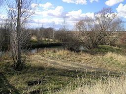
Aerial views over beardy waters woodlands glen innes nsw
Beardy Waters, a watercourse and part of the Macintyre catchment within the Murray-Darling basin, is located in the Northern Tablelands region of New South Wales, Australia.
Contents
- Aerial views over beardy waters woodlands glen innes nsw
- Map of Beardy Waters Stonehenge NSW Australia
- Etymology
- Course
- References
Map of Beardy Waters, Stonehenge NSW, Australia
Etymology
The name of the river derives from two bearded stockmen, William Chandler and John Duval, who were among the first European settlers of the district through which the river flows. The river was previously known as Maybole Creek, The Beardy Water, Beardy River and The Beardy Waters.
Course
Beardy Waters rises below the Waterloo Range and Great Dividing Range, and flows generally north-east then north, before reaching its confluence with the Severn River, north of Glen Innes; descending 317 metres (1,040 ft) over its 76 kilometres (47 mi) course.
A weir construction across the Beardy Waters was commenced in October 1930 after a grant of GB£5,500 was made available for the work. This money was granted to pay men working on unemployment relief. Completed in July 1932 at a cost of GB£10,847 it has a capacity of 100 million imperial gallons (450,000 m3) with the flood gates closed.