
Elevation 9,979 ft (3,042 m) Area 4,183 km² Country United States of America Mountains Naomi Peak, Logan Peak | Etymology Bear River Highest point Naomi Peak Parent range Wasatch Range | |
 | ||
Borders on Cache Valley (west)
Bear Lake &
Monte Cristo Range (east) | ||
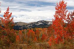
Naomi peak bear river mountains utah
The Bear River Mountains, or Bear River Range, is located in northeastern Utah and southeastern Idaho, forming the eastern boundary of the Cache Valley. One of the mountains' sinks (Peter Sinks) recorded the lowest temperature in Utah on February 1, 1985, at −69 °F (−56 °C), which is also the second-lowest temperature ever recorded in the contiguous United States. U.S. Highway 89 via Logan Canyon provides the only major route through the mountains, and the canyon is the location of Logan River, the Beaver Mountain ski resort, and Tony Grove Lake.
Contents
Map of Bear River Mountains, Idaho 83263, USA
References
Bear River Mountains Wikipedia(Text) CC BY-SA