
Founded 1896 Time zone IST (UTC+2) Area 140 km² Local time Wednesday 1:19 AM | Incorporated 1950 Website Official website Population 18,600 (2009) | |
 | ||
Weather 19°C, Wind SE at 10 km/h, 51% Humidity | ||
Be'er Tuvia Regional Council (Hebrew: מועצה אזורית באר טוביה, Mo'atza Azorit Be'er Tovia), is a regional council in the southern Coastal Plain region in Israel.
Contents
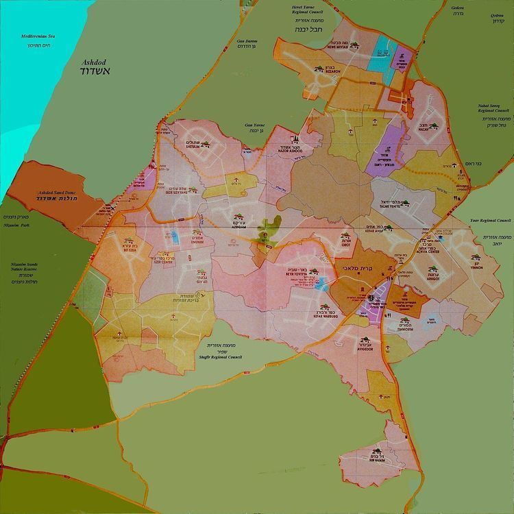
Map of Be'er Tuvia Regional Council, Israel
It borders Yoav and Nahal Sorek regional councils in the east; Hof Ashkelon regional council, the Mediterranean Sea, the city of Ashdod and Gan Yavne local council in the west; Gederot, Hevel Yavne regional councils and Gedera, Bnei Aish local councils in the north; Shafir regional council in the south. The town of Kiryat Malakhi is enclaved in the middle.
Be'er Tuvia was incorporated as a regional council in 1950, with a land-area of approximately 140,000 dunams (140 km²). According to the Israel Central Bureau of Statistics, the regional council had a population of 18,600.
Economy
Initially all settlements in the area were built as agricultural. There are lot of plantations and crop fields can be seen. Farms producing beef and milk are also developed. The Buffalo Ranch in Bitzaron is very famous.
Yet, over the years the local government developed industry on the lands that belongs to the regional council.
Today there are four industry zones:
Hatzor Airbase of the Israeli Air Force is located in the council's territory.
List of settlements
There are 23 communities including nineteen moshavim, one kibbutz, one communal settlement, a youth village and a service centre.