
Length 9 km Country Puerto Rico | ||
 | ||
Main source Barrio Montes Llanos1,650 feet (500 m)(intermittent)141 feet (43 m) (perennial) River mouth Rio Cerrillos, Barrio Machuelo Arriba42 feet (13 m) Progression Barrio Montes Llanos,barrio Machuelo Arriba | ||
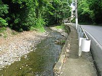
Bayagán River (Spanish: Río Bayagán) is a river in the municipality of Ponce, Puerto Rico. Bayagán is a tributary of Cerrillos River. It has a length of approximately six kilometers and generally runs south. It originates in barrio Montes Llanos and runs south through barrio Machuelo Arriba for about nine kilometers until it meets Río Cerrillos. It is part of the Bucaná River watershed. This river is one of the 14 rivers in the municipality.
Contents
Map of R%C3%ADo Bayag%C3%A1n, Ponce, Puerto Rico
Origin
Bayagán River has its origin in Montes Llanos, in an area about two kilometers northwest of Pico Pinto (English: Pinto Peak). This river extends from the mountains in Montes Llanos and gathers waters from the streams in the vicinity of 18.08908 North and 66.61629 West, in the area of Hacienda Usera.
Course and extension
Bayagán River progresses in a southernly direction through barrio Machuelo Arriba until its mouth at coordinates 18.043575 North and 66.585728 West just west of Urbanizacion Valle Alto in the city of Ponce. At that point it feeds into Cerrillos River, at an altitude of 42 feet. Cerrillos will in turn feed into Río Bucaná further downstream, with the latter emptying into the Caribbean Sea about eight kilometers further downstream.
Length and type
Bayagán is only six kilometers long. However, the river is mostly an intermittent river, being perennial only about half a kilometer of its final course. Like several other rivers in southern Puerto Rico, Río Bayagán flows perennially only during the rainy season.