
Population 216 (2011) Civil parish Bawsey Area 6.81 km² | OS grid reference TF680198 Sovereign state United Kingdom Local time Tuesday 2:47 PM | |
 | ||
Weather 7°C, Wind SW at 27 km/h, 68% Humidity District King's Lynn and West Norfolk | ||
Bawsey is a village and civil parish in the English county of Norfolk. The village is about 4 miles (6 km) east of the town of King's Lynn and 40 miles (65 km) west of the city of Norwich. The village sits astride of the B1145 Kings Lynn to Mundesley road that dissects North Norfolk west to east.
Map of Bawsey, UK
The civil parish has an area of 6.81 km2 and in the 2011 census had a population of 216 in 105 households. For the purposes of local government, the parish falls within the district of King's Lynn and West Norfolk. It forms part of the North West Norfolk constituency, represented by Henry Bellingham (Conservative). Norfolk County Council is responsible for roads, some schools, and social services, and the county councillor for Bawsey is Richard Toby Coke (UKIP).
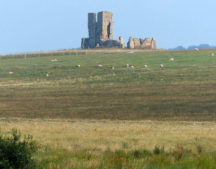
The church was dedicated to St.James and has been in ruins since at least 1745, its distinctive remains will be familiar to anyone who has travelled the A149 towards Hunstanton, standing high on a hill at church farm, the building and its surrounding area were the subject of a live dig by the Time Team program in 1998, they determined it started life as a monastic settlement before becoming the Parochial church of Bawsey, also during the weekend dig, the Norman arch under the former central tower was restored after it had collapsed some years before.