
Township 1894 Municipality Council(Majlis Perbandaran) 2001 Local time Tuesday 8:42 PM | District Council(Majlis Daerah) 1976 Postal code 83000 | |
 | ||
Administrative Areas ListBatu Pahat townTongkang PechahParit RajaSenggarangRengitSri GadingSemerahPura KencanaParit Besar (Bagan)Simpang LimaPeserai Weather 26°C, Wind NE at 6 km/h, 89% Humidity Points of interest Dataran Penggaram Batu Pahat, Wet World Batu Pahat Village R, Mount Banang, Kim Kang Aquaculture Sdn Bhd | ||
Not to be confused with Batu Pahat District, district area included Batu Pahat town and Yong Peng
Contents
- Map of Batu Pahat Johor Malaysia
- Etymology
- History
- Geography
- Administration
- Population
- Languages
- Religion
- Economy
- Education
- Primary schools
- Secondary schools
- Tertiary education
- Hospitalmedical centres
- Barisan Nasional
- Pakatan Rakyat
- Business
- Celebrities
- References
Map of Batu Pahat, Johor, Malaysia
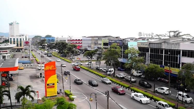
Batu Pahat town (Bandar Penggaram or BP) is a town and capital of Batu Pahat District, Johor, Malaysia. It lies south-east of Muar (a royal city), south-west of Kluang, north-west of Pontian and south of Segamat. The town area is located inside Simpang Kanan parishes.
As of 2009, Batu Pahat town is the 20th largest urban area in Malaysia in terms of population. In 2006, Batu Pahat surpassed Muar to become the second largest urban area in Johor and by 2012, Batu Pahat is the 16th largest urban area in Malaysia in terms of population.(Malaysia Population). As for the racial demography, Chinese make up the majority of the population at 62% followed by the Malay at 36% and Indians at 2%. There are significant percentage of Chinese in the population of Batu Pahat today.
Etymology
The name Batu Pahat means "chiselled rock" in Malay. The origin of this name can be traced back to a local lore in the 1546, when the invading Siamese troops led by Admiral Awi Di Chu were chiselling rocks at a rocky spot in the coastal village of Kampung Minyak Beku, in hope of getting fresh water during their siege on the Malacca .
History
Batu Pahat originally was a remote residential areas for the royalties and the mayor of the villages. There was already a successful township nearby, Bandar Maharani that was established in 1885 by Dato' Muhamad Salleh bin Perang or popularly known as Dato' Bentara Luar. It was until in the year 1892, the local mayors (Penghulu) such as Penghulu Rahmat bin Ragam (Simpang Kanan) dan Penghulu Kitam bin Mohd. Shah (Simpang Kiri) requested audience with Sultan Abu Bakar to develop a township in Batu Pahat. They believe that Dato' Bentara Luar will once more duplicate the success of Muar known by other name, Bandar Maharani into new up and coming township. On 4 November 1892, Sultan Abu Bakar orders Dato' Bentara Luar who was then living in Kampung Senangar to come over to Johor Bahru palaces to seek for an audiences related to new township development matters.
The next month, Dato' Bentara Luar started on the Batu Pahat township development. He chooses the development places in Simpang Kanan parishes which are about 15 km away from Batu Pahat river bay. The locations is strategic as the river's berth are wide enough to let the ship passing thru as well as the construction of docks will facilitate the trading in that areas. On 2 December 1892, the fakir already starts to survey the land from Mount Penggaram to the Pengarram river for the township planning purposes. Within the next year, he succeeded in building up roads, offices, courts, hospital, police stations and also homes around that area. The development is sustained by the finances support by Orang Kaya Bagan, taxes from local populaces and as well as the personal wealth of the Dato' Bentara Luar himself.
On 1 January 1894, Dato' Bentara Luar officiates the Batu Pahat opening ceremony in Bukit Bendera which are now the official residency of the Batu Pahat town administrator. In Dec. 1894, another events held to commemorates the naming of Batu Pahat into Bandar Pengarram which had taken names from Kampung Pengarram where the Penghulu Rahmat resides.
During his reign as the Government Commissioner, Dato' Bentara Luar modernises the administrative duties by appointing the administrative officers to do their duties. He also encourage the villagers to plant crops for self-sufficiency and pulls in investment from Chinese businessman to set up plantations or set up trading in Batu Pahat. This led to increases in the town council income from RM15,00 in 1894 to Rm55,375 in 1910.
Geography
Batu Pahat is situated at 1°51′N, 102°56′E in the state of Johor in southern Peninsular Malaysia. It is located 239 km to the south of Kuala Lumpur. The closest town to Batu Pahat is Muar, which is located 50 km to the northwest of this town. The town of Kluang is located about 52 km to the southeast. Johor Bahru, the capital of Johor, is located about 130 km to the south east of the town. 95 km to the north west is the Malaysian historical city, Melaka.
The district itself borders the district of Segamat to the north, Kluang to the east, Muar to the west and shares a border in the southeast with the district of Pontian. The coast of the Strait of Malacca lies to the south.
Administration
Batu Pahat is administered by Batu Pahat Municipal Council (MPBP) which was upgraded from the previous Majlis Daerah Batu Pahat Barat (MDBPB) or the West Batu Pahat District Council.
Batu Pahat district has 525 gazetted villages (kampung-kampung) and village-clusters (kampung rangkaian) where smaller villages were annexed to their bigger immediate neighbours for the purpose of administration. The villages are represented by their village heads (ketua-ketua kampung) who answer to the subdistrict chief (Penghulu) administering the Mukim. The Mukim itself however is under the jurisdiction of the Pegawai Daerah or District Officer. The district office of Batu Pahat also has five district engineers (Jurutera Daerah) to oversee all the sub - districts.
Population
The city of Batu Pahat has a population of more than 300,000. There are more than 100,000 households with 468,058 population in this district. The most populated mukim is Simpang Kanan with more than 250,000 people and the least populated is Bagan with a population of only 4,692.
Overall district-wide population distribution based on gender are almost equal with a male population of 169,087 and female population of 166,281.
Batu Pahat city is made up of 37.08% Bumiputeras (mainly Malays), 60.29% Chinese, and 2.54% Indians and other less numerous races.
Languages
The Chinese community in Batu Pahat are mainly descendants of people from southern Fujian (Quanzhou, Xiamen and Zhangzhou) and the Chaozhou region of Guangdong province. Therefore, Hokkian or minnan and Teochew are vernacular in this region, then followed by Hakka dialects and significant minority Cantonese and Hainanese dialect. Batu Pahat Chinese people usually converse in Mandarin due to the close proximity to Singapore and its media reception in the area. The Chinese dialect spoken by most of the citizens of Batu Pahat is Southern Malaysia Hokkien, which is distinct from Penang Hokkien.
The Malay community of Batu Pahat usually spoke the Johorean Malay dialect.
The Indian community in Batu Pahat is mostly made up of ethnic Tamils which speak Tamil language with a distinctive Malaysian accent.
Religion
In Batu Pahat, there are a lot of religion worships and the major are Islam, Buddhism, Christianity, Taoism, Hinduism and Confucianism.
There are over 400 temples in Batu Pahat district and temples are one of the tourists attractive place for tourists from other state of Malaysia (especially tourists from Melaka, Negeri Sembilan, Selangor and Kuala Lumpur) and even Singapore during weekends. Temples located in Segenting, Pantai Minyak Beku, Senggarang and Bukit Pasir are the hotspot places to visit by tourists.
There is a strong belief that good luck is bestowed on the prayers and they do come back very often. Some of these temples are beautifully renovated and thus have also become a tourist attraction. Every weekends, there will a lot of traveling buses from many places especially Singapore, to visit the temples in Batu Pahat.
Economy
Batu Pahat is one of the Johor's manufacturing industrial town which includes textiles, electronics, food-processing, timber, porcelain and plastic industry.
There are several industrial zones including Tongkang Pecah, Parit Raja, Sri Gading, Sri Sulong, Lian Aik and Buditama, ranging from 20 acres (81,000 m2) to 200 acres (0.81 km2).
There are few foreign multi national company setup in Batu Pahat during 80's and 90's such as Sharp Roxy, Fujitsu and Mitsumi as well as many other local public listed companies.
Agriculture is another important source of income for the locals. Batu Pahat has some of the largest rubber, oil palm, coconut and cocoa plantations in Johor. Fruit produce such as watermelons, papayas, bananas, pineapples, durians and 20 varieties of vegetables are exported. There are also several fishing villages such as Segenting which provides sources of fisheries.
Education
Educational institutions in Batu Pahat encompass primary to tertiary education.
Primary schools
There are 101 national primary schools whose medium of instruction is Malay language and 38 Chinese primary schools. Most well known is Montfort Primary School which caters to boys and Convent Girls' School which caters to girls.
Secondary schools
The most prominent secondary schools are High School Batu Pahat (高级中学), Temenggong Ibrahim Girls School (天猛公依布拉欣女中), Sekolah Menengah Kebangsaan Dato' Bentara Luar (拿督文达拉鲁哇国中), Sekolah Menengah Kebangsaan Dato' Syed Esa (拿督赛依瑟国中) which was formerly known as Sekolah Menengah Kebangsaan Jalan Kolam Air (水池路国中).
In addition, there is a Chinese independent high school located in the town named 华仁中学 Chinese High School (Batu Pahat).
Tertiary education
For tertiary education, there are:
Hospital/medical centres
There are government owned and private owned hospital and medicare centres: