
Local time Thursday 2:59 AM | Region Normandy Area 5.63 km² | |
 | ||
Weather 6°C, Wind SW at 26 km/h, 75% Humidity | ||
Banneville-sur-Ajon is a former commune in the Calvados department in the Normandy region of north-western France. On 1 January 2016, it was merged into the new commune of Malherbe-sur-Ajon.
Contents
- Map of Banneville sur Ajon France
- Geography
- Toponymy
- Administration
- Demography
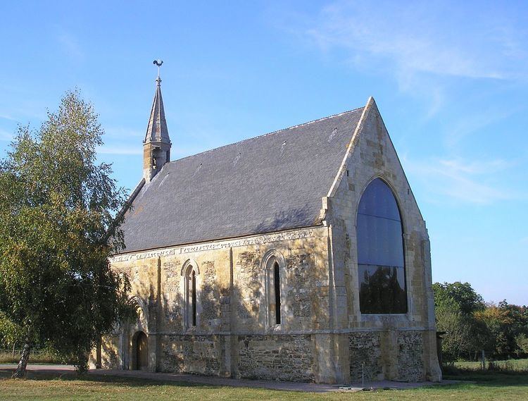
- Sites and monuments
- References
Map of Banneville-sur-Ajon, France
The inhabitants of the commune are known as Bannevillais or Bannevillaises.
Geography
Banneville-sur-Ajon is located some 20 km south-west of Caen and 7 km south-east of Villers-Bocage. Access to the commune is by the D121A from Saint-Agnan-le-Malherbe in the south which passes through the centre of the commune and the village and continues north to join the D8. The D171 from Landes-sur-Ajon to Préaux-Bocage passes through the north-east of the commune. Apart from the village there are the hamlets of La Fêterie in the south and Gournay in the north. The commune is almost all farmland.
The Ajon river flows through the commune from south-east to north-west continuing to join the Odon south-west of Le Locheur. The Orgeuil river rises in the south of the commune and flows north-east through the length of the commune to join the Ajon. The Ruisseau de la Rette flows from the south to join the Orgeuil.
Toponymy
Banneville-sur-Ajon was Barneville sur Ajon in 1371. René Lepelley attributed the origin of the name to the Germanic anthroponym Benno with the Old French suffix -ville meaning "rural domain".
Administration
List of Successive Mayors
(Not all data is known)
Demography
In 2010 the commune had 379 inhabitants. The evolution of the number of inhabitants is known from the population censuses conducted in the commune since 1793. From the 21st century, a census of communes with fewer than 10,000 inhabitants is held every five years, unlike larger communes that have a sample survey every year.
Sources : Ldh/EHESS/Cassini until 1962, INSEE database from 1968 (population without double counting and municipal population from 2006)