
 | ||
Banghushree. (बनघुश्री)
Contents
Map of Banghushree, Gobardiya 22404, Nepal
sometimes banghusri (बनघुस्री), Bankhorsi(बनखोर्सी) is a village located in Gobardiya VDC in Dang Deukhuri District, Nepal. It is one of the oldest villages of Deukhuri Valley.
Introduction
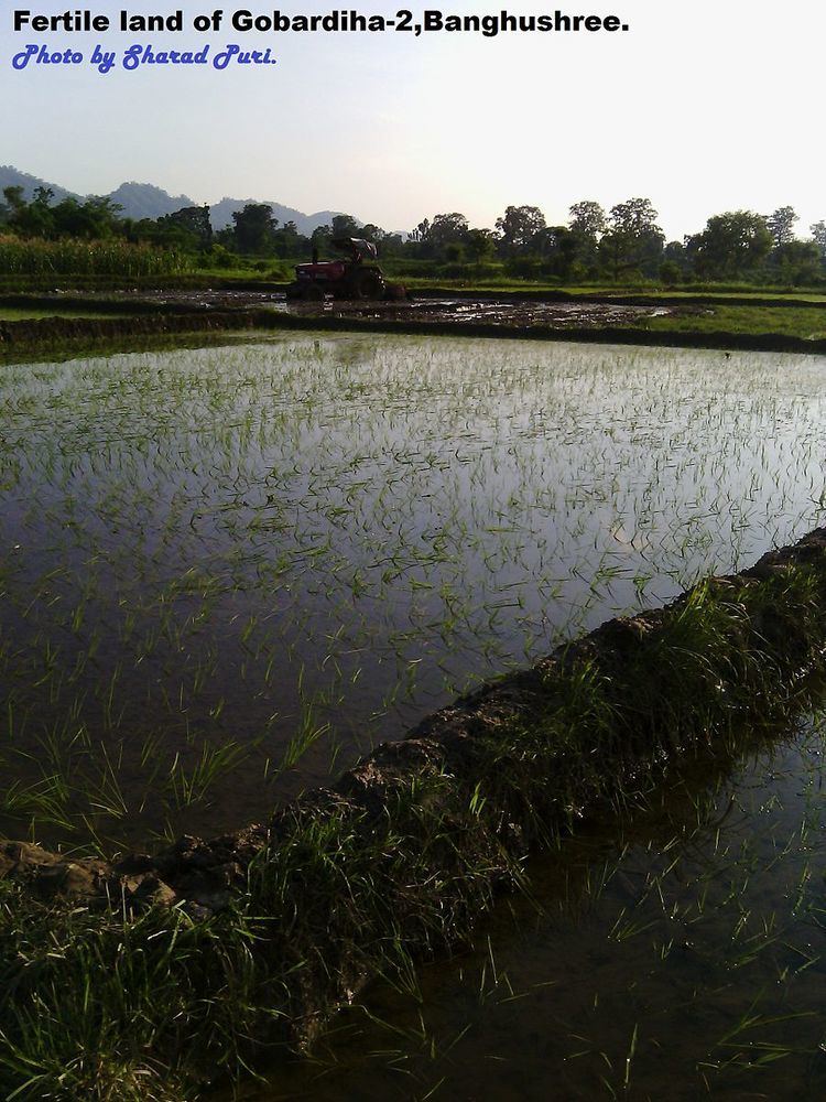
Agriculture is the main occupation of peoples and no industrial colony has been established.
Height from sea level: south- 310 meters, north- 290 meters. Total households-210 including Banbari, Population- more than 1100. This village is known for its higher fertile land. Village is situated in northern side of two roads: damodar road and Dulaiya road.
Peoples there mainly cultivate grains, vegetables, herbs and plants,many peoples are attracted towards livestock production and processing. This village holds four conservation areas which are Janashakti samudayik ban, Banshakti samudayik ban, Mahila ban and Kharkatti conservation area. N.L. livestock has established there with the aim of industrializing in production of livestock.
This village has one school named Nimna madhayamik vidhyalaya, which was established with the initiation of Dulaiya in 2025 B.S. This school is a fully government school which currently holds nearly 400 children of age between 5 and 13 years old. School children come from nearby villages such as Banghushree,Badahara, Patringa, Bauraha. At present, school is running with new committee.
Bauraha khola, which runs from south to north, is lying in west side of this Banghushree village. In the time of monsoon season, it causes huge loss of property. Upper large catchment area where high precipitation in monsoon season results devastating flash flood each year which turns into nightmare for the locals of Banghushree. Bauraha khola, which generally carries mud, boulders and lots of debris due to steep slope, sweeps fertile land of Banghushree each year. Land of Banghushree, in terms of geology, is new. which was formed by sedimentation of sand, soil and small pebbles. Many kinds of sedimentary rocks are therefore, found there
Name of dry streams you must cross to reach on Banghushree village from Kalakate are listed below:
- Kalakate khola
- Bhalu khola
- Bire khola
- Forester khola
- Kolte khola
- Budi khola
- Lahure kate khola
- Tharunijhundi khola
- Parshampure khola
Distance from kalakate to demarcation between malmala and Banghushree is nearly 3.5 kilometers.
History
Banghushree was forest before the presence of Dulaiya Dashanami Sampradaya. They made place suitable for residency at the time of Anglo-Nepalese War by clearing land of Banghushree. Dulaiya arrived Banghushree in 1870 Vikram Samvat. Historical monuments, some left documents and some historians indicate that Dulaiyas houses were built there for Homestay. Nepalese workers from India, while returning towards their home, used to live there. At that time, Business of Dulaiyas in the sector of Hospitality was sound. There was no bridge on West Rapti River and peoples used to travel through Banghushree. Dulaiyas used to serve for the literate guest in different way. Dulaiyas had built separate houses for literate guests and they used to tell guests to teach their children instead of paying fees. Banghushree village was a center of attraction for migrating peoples for their permanent residency because this village had fertile land, along with this there was proper water supply, reliable energy source and proper management of transportation than other nearby villages.