
Postal code 65110 Chief Roadway Route 1063 Population 4,671 (2005) | Geocode 650502 Local time Wednesday 9:35 PM Province Phitsanulok Province | |
 | ||
Weather 30°C, Wind SE at 8 km/h, 44% Humidity Amphoes Phitsanulok Province, Bang Krathum District | ||
Ban Rai (Thai: บ้านไร่) is a subdistrict (tambon) in the Bang Krathum district of Phitsanulok Province, Thailand.
Contents
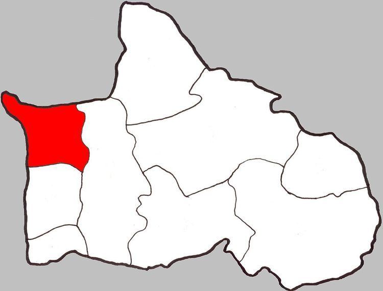
Map of Ban Rai, Bang Krathum District, Phitsanulok, Thailand
(Do not confuse it with Ban Rai, Uthai Thani, which is a district (amphoe) in Uthai Thani Province, Thailand.)
Geography
Ban Rai borders Amphoe Bang Rakam and Wang Nam Khu of Amphoe Mueang Phitsanulok to the north, Bang Krathum to the east, Khok Salut to the south and Phichit Province to the west. Most of Ban Rai lies within the Nan Basin, although a narrow strip of land on the west side of the subdistrict lies within the Yom Basin. Both basins are part of the Chao Phraya Watershed. The Nan River flows through Ban Rai at Ban Khok Salut, and the Yom River forms part of the subdistrict's border with Phichit.
Administration
The subdistrict is subdivided into 10 smaller divisions called (muban), which roughly correspond to the villages in Ban Rai. There are 6 villages, several of which occupy multiple muban. Ban Rai is administrated by a Tambon administrative organization (TAO). The muban in Phai Lom are enumerated as follows:
Temples
Ban Rai is home to the following four temples: