
Population 328 (2011 census) | Postcode(s) 3407 Postal code 3407 | |
 | ||
Location 334 km (208 mi) NW of Melbourne78 km (48 mi) SW of Horsham64 km (40 mi) N of Hamilton48 km (30 mi) N of Coleraine30 km (19 mi) SE of Harrow Federal division Electoral district of Lowan | ||
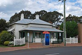
Balmoral is a township in the Shire of Southern Grampians in the Western District of Victoria, Australia. At the 2011 census, Balmoral and the surrounding area had a population of 328. In 2013 ABC News reported that Balmoral's population had fallen to 185 people, calling into question its status as a town according to the Australian Bureau of Statistics' definition of a town.
Map of Balmoral VIC 3407, Australia
The township was settled in the early 1850s, the Post Office opening on 31 October 1855.
A railway line, built in a number of sections, once connected Horsham and Hamilton, running via Cavendish, Balmoral and East Natimuk. The majority of the railway track has been removed, though several rail bridges remain in place.
The town in conjunction with neighbouring township Harrow has an Australian Rules football and netball club competing in the Horsham & District Football League.
Golfers play at the Balmoral Golf Club on Rocklands Road.