
Time zone WET (UTC+0) Area 14 km² | Irish Grid Reference Q869126 | |
 | ||
Ballyseedy (Irish: Baile Uí Shíoda, meaning "town of Sheedy") is a townland in County Kerry, Ireland. It was historically situated in the parish of Ballyseedy, within the barony of Trughanacmy. The townland contains a number of notable landmarks, including Ballyseedy Wood, a bridge over the Ballycarty River and a ruined Protestant church. There is also a large restored castle (Ballyseedy Castle) which is in use as a hotel.
Contents
Map of Ballyseedy, Co. Kerry, Ireland
Location
Ballyseedy is located off the N21 road, 4 kilometres (2.5 mi) southeast of Tralee. A section of the River Lee, from which Tralee takes its name, forms the northern edge of the townland.
History
Ballyseedy Wood is an ancient woodland dating at least to the 16th century, when it was mapped by Sir Edward Denny. The wood contains the ruins of Ballyseedy House (or Old Ballyseedy Castle). Alongside nearby "New" Ballyseedy Castle (now restored as a hotel), this was the seat of the Blennerhassett family from around 1586 to 1967.
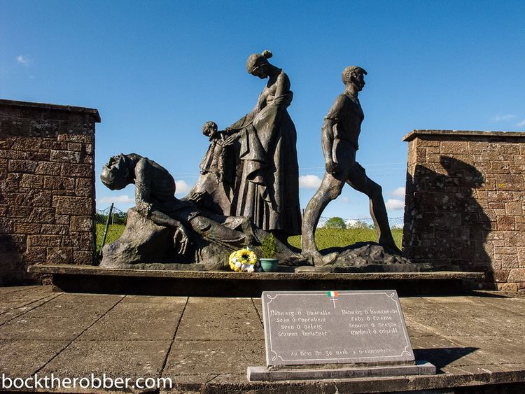
Ballyseedy Massacre
The townland was the scene of an atrocity in the Irish Civil War, in which eight anti-Treaty IRA prisoners were killed by their captors, members of the Free State forces.