
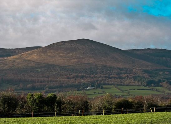
Country Republic of Ireland | Elevation 528 m Peak Seefin | |
 | ||
Similar Lough Gur, King John's Castle, Seefin, Hunt Museum, Glen of Aherlow | ||
The Ballyhoura Mountains (Irish: An Sliabh Riabhach) are located in south-east County Limerick and north-east County Cork in central Munster, running east and west for about 6 miles on the borders of both counties.
Contents
Map of Ballyhoura Mountains, Glenanair West, Co. Limerick, Ireland
FeaturesEdit
The southern part of the hills is largely afforested with conifers, on the northern side there is extensive heathland and blanket bog. The mountains include Seefin (528m, 1702 ft), near Seefin on the northwest is Black Rock (516m, 1696 ft) and 3 miles to the west is Carron Mountain (c.440m, 1469 ft) on the boundary of Cork and Limerick. Immediately east of Seefin is Knockea (1311 ft), east of which again is the detached mountain of Knockeennamroanta (1319 ft). Between these is the pass of Barnaderg, now called Redchair, leading from the plain of Limerick to the plain of Cork. At the north side of the valley is the peak of Barnageeha (1196 ft).
The Ballyhoura Mountain Bike Park situated near under Seefin and Blackrock is the largest Trail network of its kind in Ireland. The trails range from the moderate 6 kilometre Greenwood loop to the demanding 50 kilometre Castlepook loop The nearest towns and villages to the Trailhead are Ardpatrick, Glenosheen, Ballyorgan and Kilfinane.