Admin. region Freiburg Time zone CET/CEST (UTC+1/+2) Area 7.61 km² Population 1,091 (31 Dec 2008) Dialling code 07424 | Postal codes 78582 Local time Tuesday 11:46 PM Postal code 78582 Administrative region Freiburg | |
 | ||
Weather 1°C, Wind SW at 24 km/h, 89% Humidity | ||
Balgheim is a municipality in the district of Tuttlingen in Baden-Württemberg in Germany.
Contents
Map of Balgheim, Germany
Geography
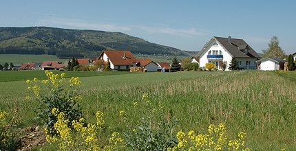
Balgheim lies in a basin on the edge of the Baar at the foot of the Swabian Jura and the Dreifaltigkeitsberg (Holy Trinity Mountain). The European Watershed, the divide between the Rhine and Danube watersheds, occurs in the town's territory. The source of the Prim, which joins the Neckar (a tributary of the Rhine) in Rottweil, is located only a kilometer away from the source of the Faulenbach, an eventual tributary of the Danube, in neighboring Dürbheim.
Balgheim is bordered by Böttingen to the north, Dürbheim to the southeast, Rietheim-Weilheim to the south, and the city Spaichingen to the west.
History
Tombs dating from the Merovingian dynasty indicate that Balgheim was founded in the 6th or 7th century. It was first mentioned in writing in 1113. In 1420 it was sold to the Free Imperial City Rottweil, where it remained until 1689, after which its rule changed often until it became part of Württemberg in 1806.
Politics
Balgheim belongs to the Amt Spaichingen.
Transportation
The Bundesstraße 14 (federal highway) between Rottweil and Tuttlingen passes by the east edge of Balgheim. The Gäubahn (Stuttgart-Singen) passes over the European Watershed here. On workdays the Ringzug (train) provides hourly connections to Rottweil, Tuttlingen and Geisingen-Leiferdingen.
