
Topo map USGS Mirror Lake Prominence 556 m Easiest route Hiking | Elevation 3,640 m Parent range Uinta Mountains | |
 | ||
Similar Hayden Peak, Deseret Peak, Twin Peaks (American Fork), Kings Peak, Delano Peak | ||
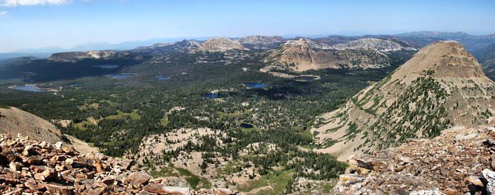
Bald Mountain is a peak in the western Uinta Mountain Range. It is an easy hike from Bald Mountain Pass and has spectacular views of the surrounding areas. The mountain is home to mountain goats, pika, and many species of wildflowers.
Map of Bald Mountain, Utah 84031, USA
Because Bald Mountain is a relatively easy hike, it is among the most popular major mountain hikes in Utah. The hike to the summit can be completed in 2 to 3 hours round trip. The trail gains 1,250 feet (381 m) of elevation in 2 miles (3 km).
As in any high-altitude adventure, hikers need to plan this trek for early in the day to avoid afternoon thundershowers and life-threatening lightning. The route contains no real obstacles, although snow along the southern ridge, about 1 mile (2 km) into the hike, can frustrate and turn back hikers unfamiliar with traversing steep snow. When snow is not present, hikers of all abilities should have little problem with this route.